Mapping Manhattan Chinatown’s Public Realm

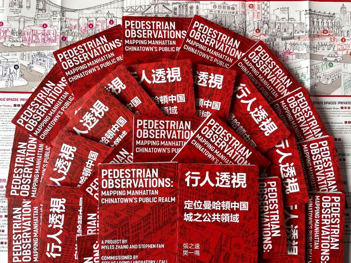
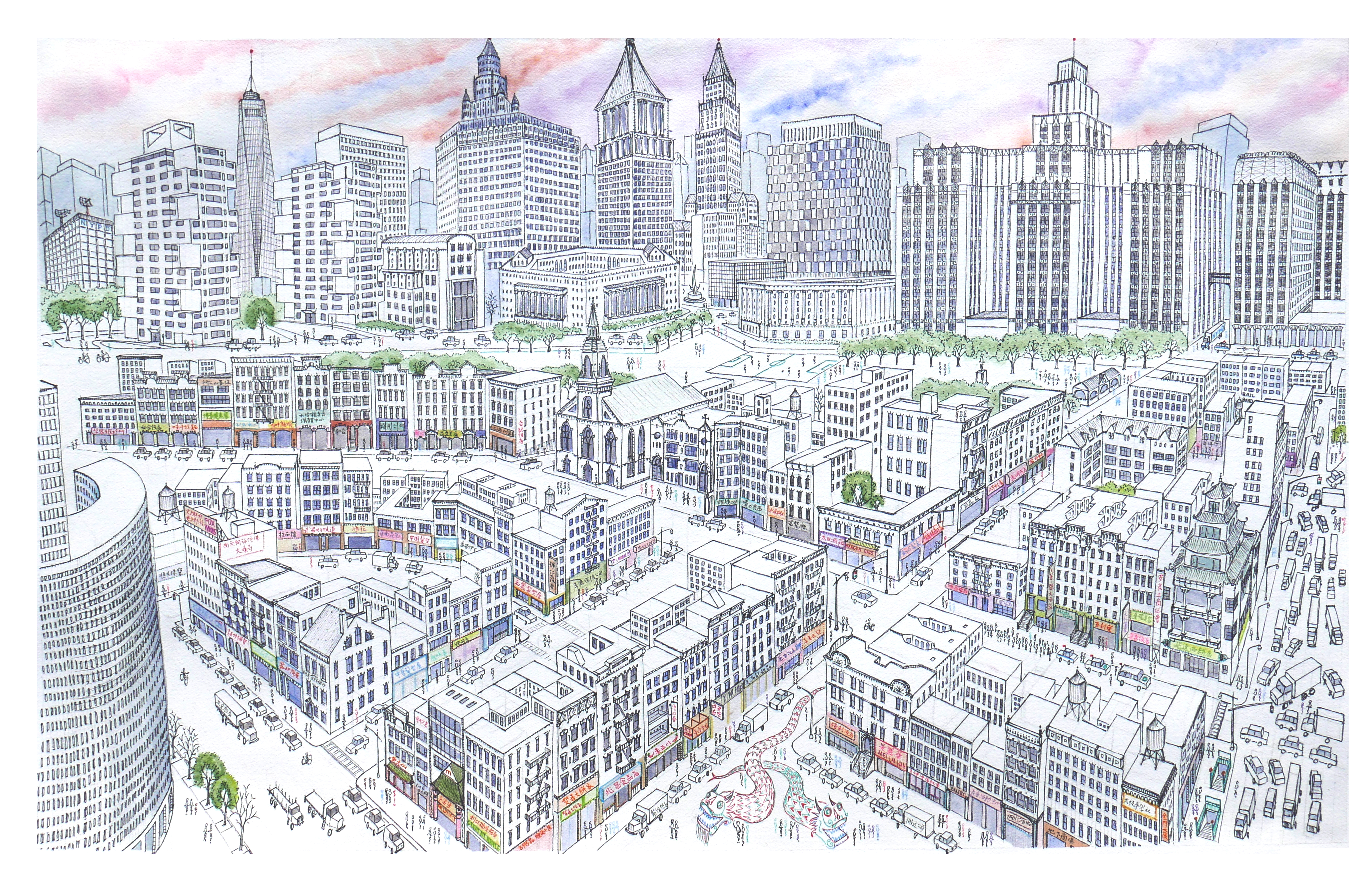
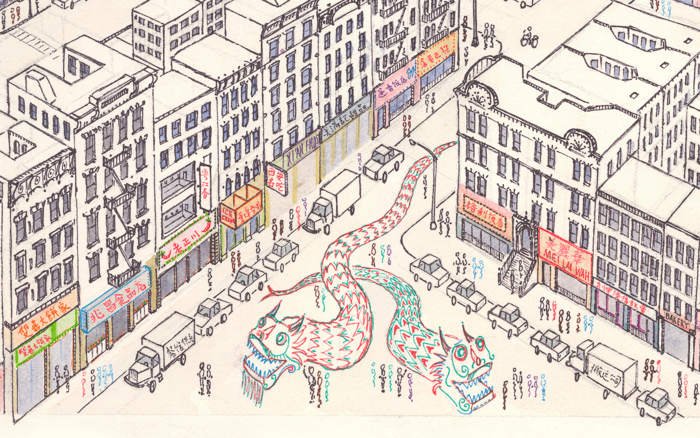
Pedestrian Observations explores Manhattan’s Chinatown’s public and private spaces through a detailed panoramic drawing and map of contested land uses. This project was co-published by Myles Zhang with non-profit artist collective City as Living Lab and architect Stephen Fan. The printed folding map highlights the vibrant interactions among diverse community members, while emphasizing the need for better public space management. Inspired by urban theorists, the project seeks to foster conversation about economic development and resilient urban environments.

《行人观察》(Pedestrian Observations)通过一幅详尽的全景绘图及一张描绘土地利用争议的地图,对曼哈顿华埠的公共与私人空间进行了深入探索。该项目由 Myles Zhang 与非营利艺术家团体“城市即活体实验室”(City as Living Lab)及建筑师 Stephen Fan 联合出版。这份印制的折叠地图不仅突显了多元社区成员之间充满活力的互动,同时也强调了加强公共空间管理的必要性。受城市理论家的启发,该项目旨在促进关于经济发展与韧性城市环境的对话与探讨。
Visit: CityasLivingLab.org/chinatown VIEW PUBLICATION

Architecture of Endurance in Manhattan Chinatown

Walking tour with observations of Chinatown’s history and streetscape.
Created for the Jane’s Walks tour series, and hosted by the Municipal Art Society of NY.

Illustrated with original watercolors for City as Living Laboratory
VIEW PUBLICATION

Architecture of Exclusion in Manhattan Chinatown

This essay discusses the historical and contemporary challenges faced by the Chinese community in Manhattan’s Chinatown, highlighting the impact of the 1882 Chinese Exclusion Act and ongoing racial discrimination. Despite systemic barriers, the community has shown resilience, maintaining its cultural identity amidst gentrification and urban development while navigating social and economic inequalities. VIEW PUBLICATION

A Brief History of Mulberry Bend

At the intersection of history and the immigrant experience Written for Kenneth Jackson’s Columbia University undergraduate course “History of the City of New York” Mulberry Bend c.1896. Buildings on left side of street are now demolished. Mulberry Bend, nestled between the New York County Criminal Court and the tenements of Chinatown, is at the geographic crossroads of New York City history. At 500 feet long and 50 feet wide, Mulberry Bend is between Bayard Street to the north and Worth Street to the south. Named after the slight turn the street makes midblock, the Bend has a rich, over 350… VIEW PUBLICATION

New York Chinatown: time-lapse drawing

This time-lapse of Manhattan Chinatown took sixty hours to complete and measures 26 by 40 inches. The artwork features Chinatown’s tenements in the foreground, with Lower Manhattan’s skyscrapers towering above. This panoramic map depicts Chinatown’s urban core, as bounded by Bowery, Canal Street, and Columbus Park.

Drawing is shared online in lower resolution. Email me for the full-size file. Custom size prints will be mailed to your home address on request. VIEW PUBLICATION

Walking in Manhattan

This project features a portfolio gallery of my drawings, watercolors, paintings, and photographs of Manhattan island. The portfolio is divided into ten “walks” over the chapter structure of ten “days.” Each “day” features some of my artwork about a different neighborhood of Manhattan: Chinatown, SoHo, East Village, West Village, the High Line, Madison Square, Midtown, Central Park, Riverside Drive, Morningside Heights, Harlem, and Washington Heights. VIEW PUBLICATION

Chinatown: a living neighborhood

View more artwork like this about my experiences walking in New York City. . . Chinatown is both static and dynamic: Static in its resilience against gentrification, dynamic in its cultural interplay between past and present, immigrant and American. Everywhere in Chinatown, past and present intermingle. Dusty and decrepit Jewish textile stores struggle onward; their elderly owners wait to close up shop and sell out for millions to developers. By Division Street rests a former synagogue with an AT&T outlet on one side and a Chinese-language job agency on the other. Bustling bakeries and bodegas abut reminders of past immigration…. VIEW PUBLICATION