
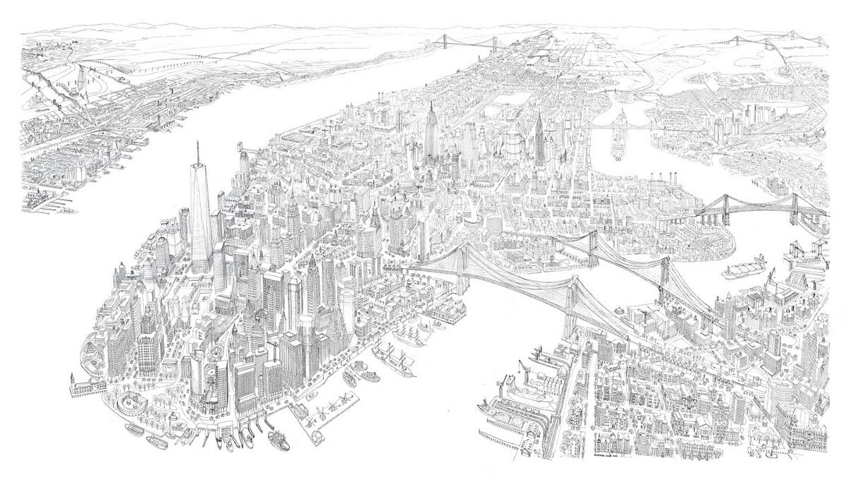
The scan above is suitable for viewing but not for large-format printing. Please request access to the full-size scan at ~400dpi
View full size
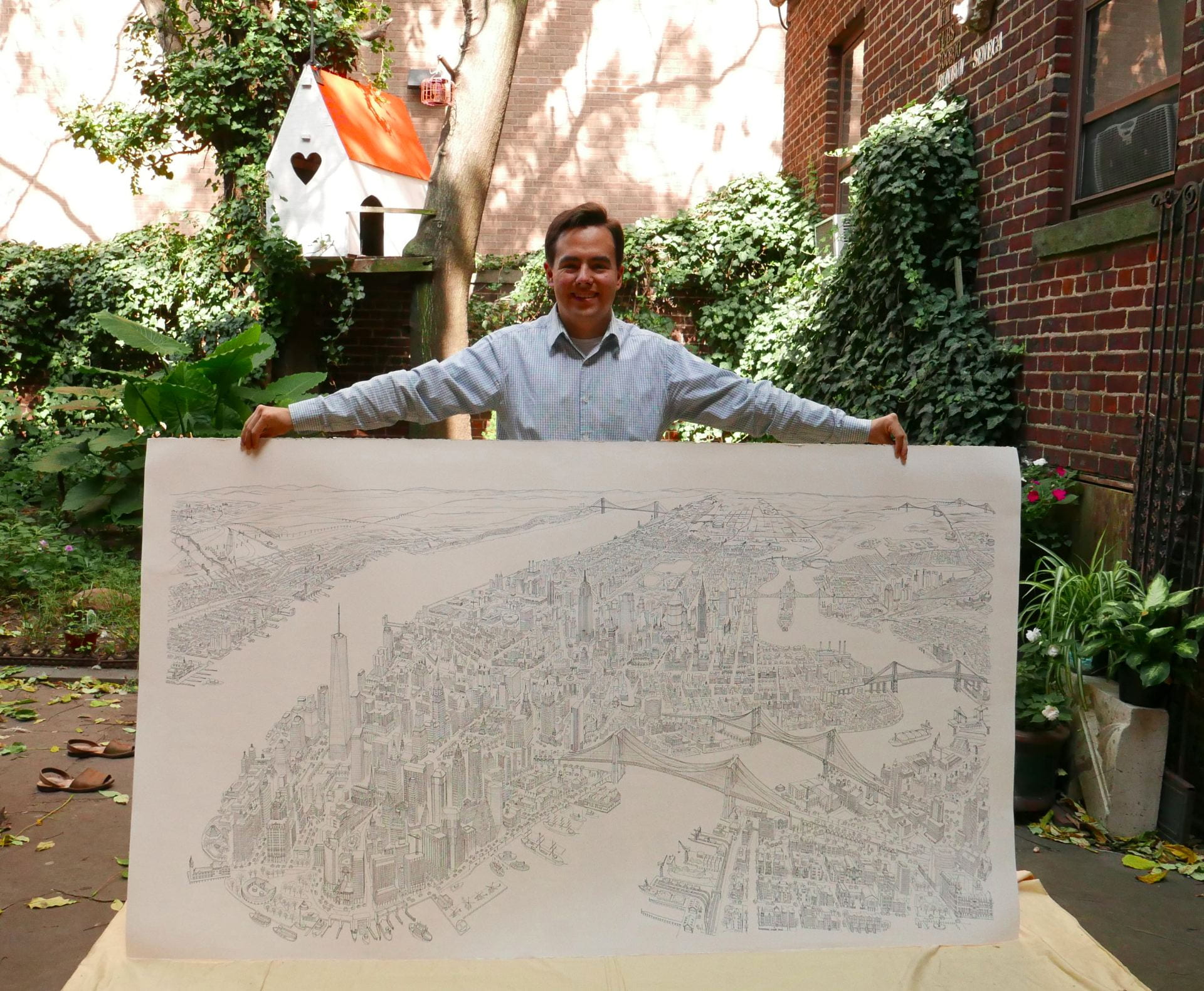
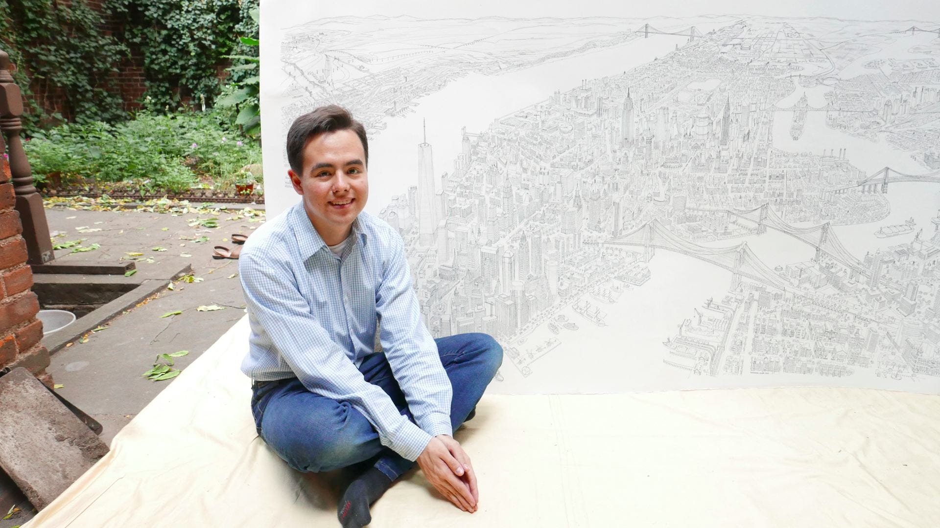
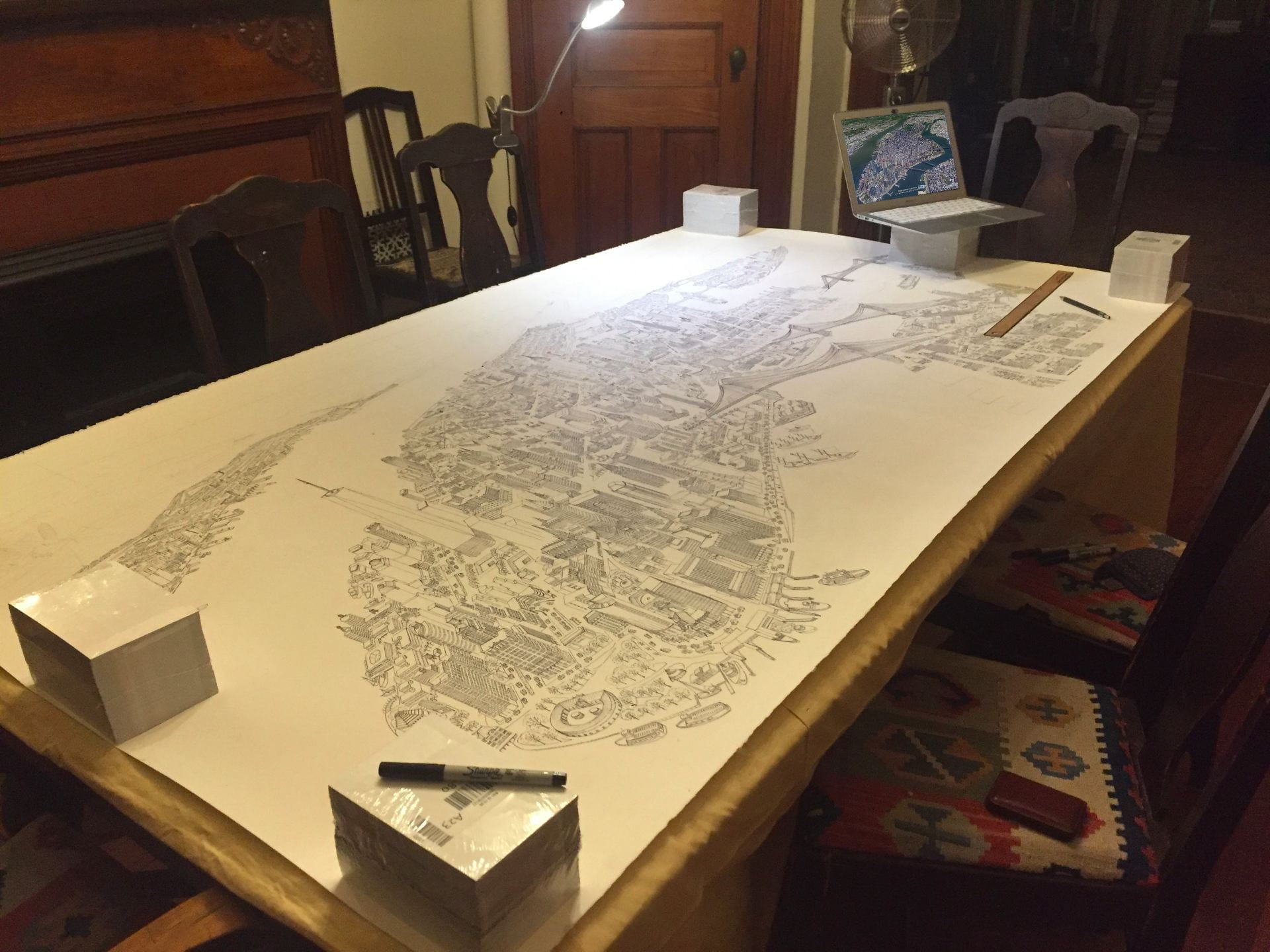
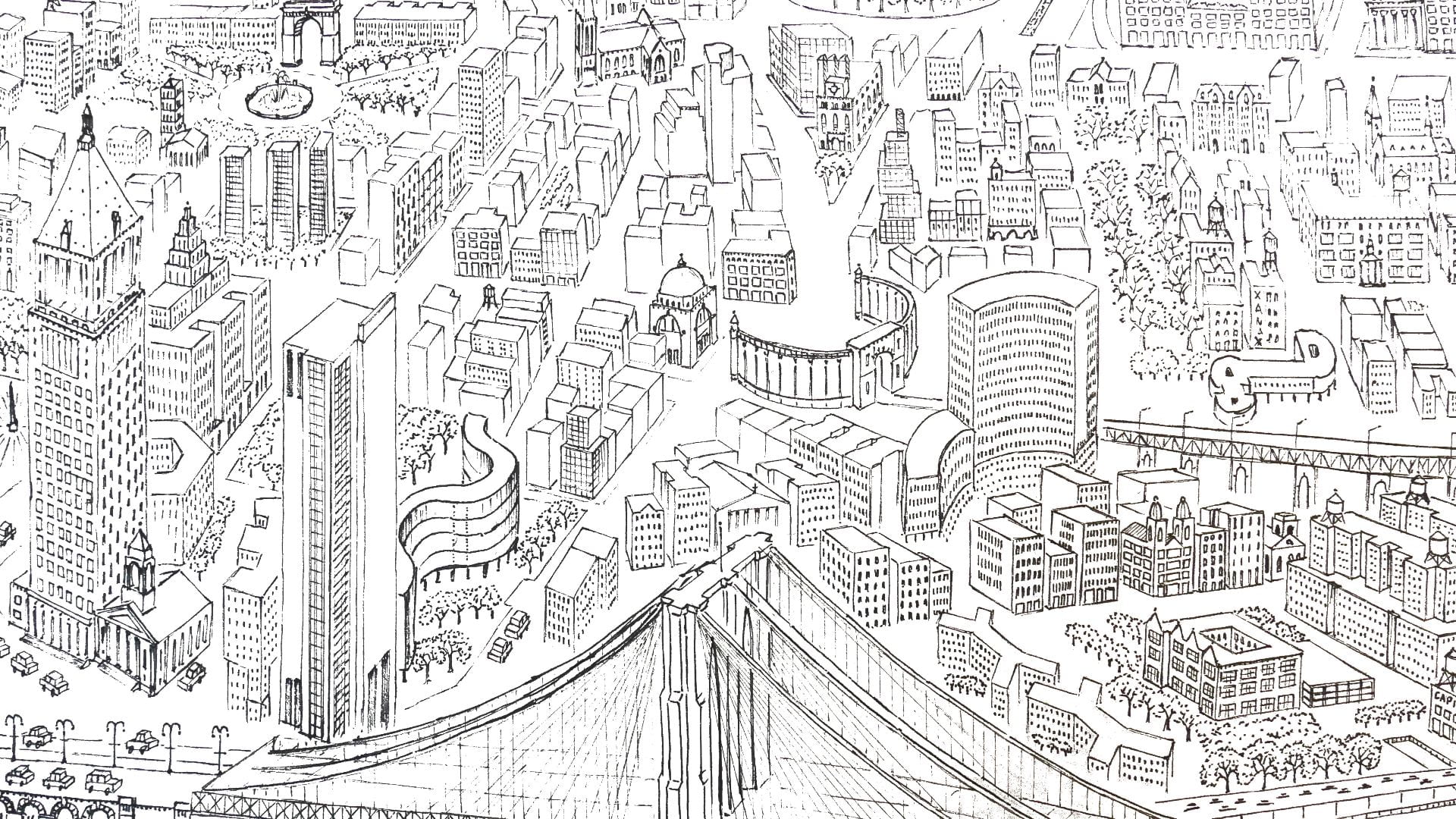
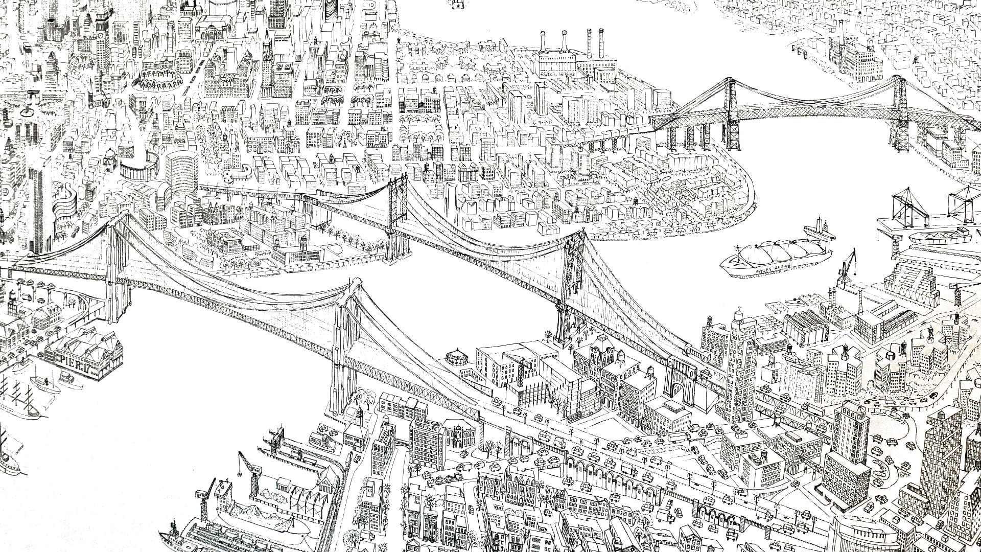
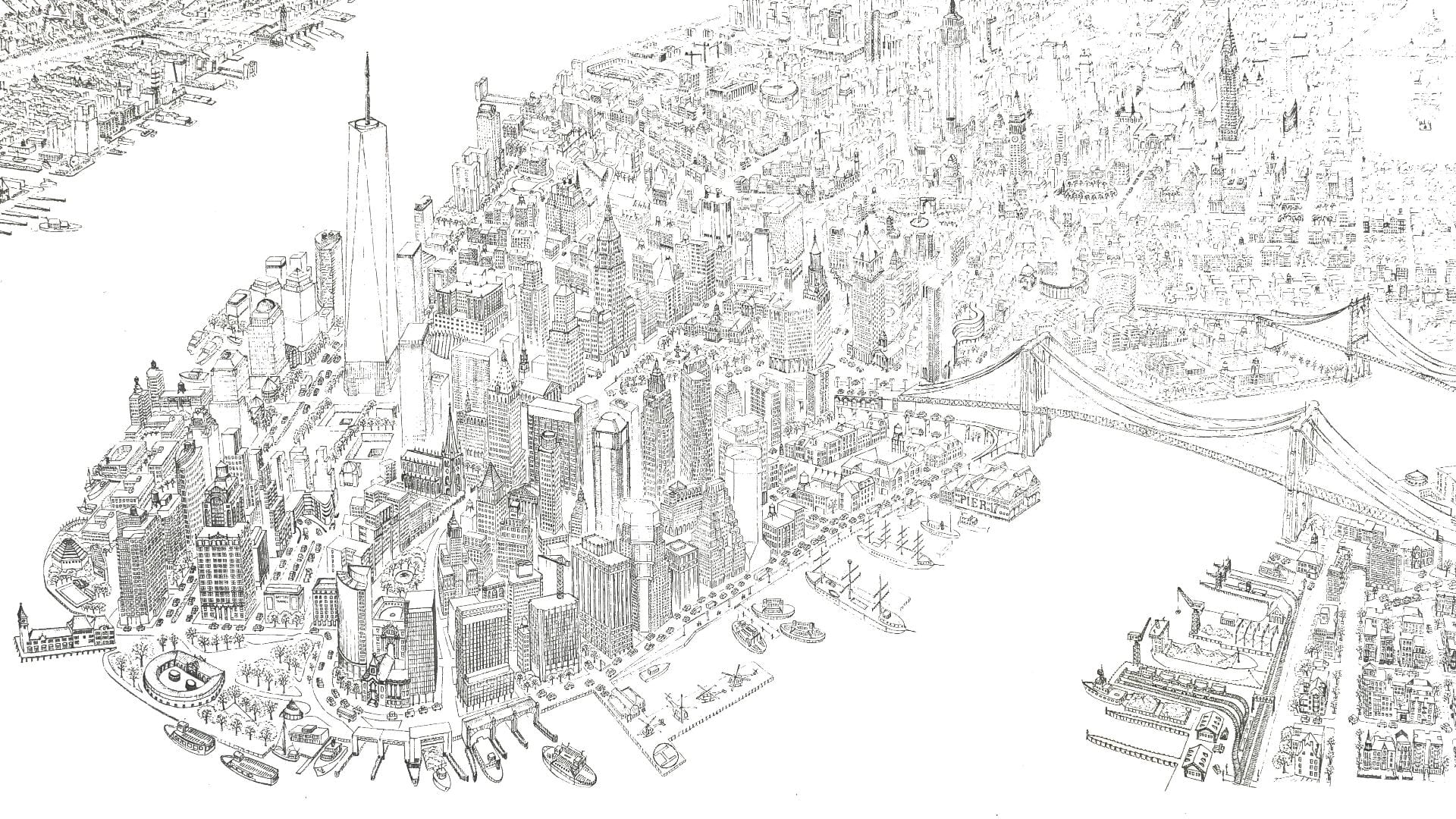
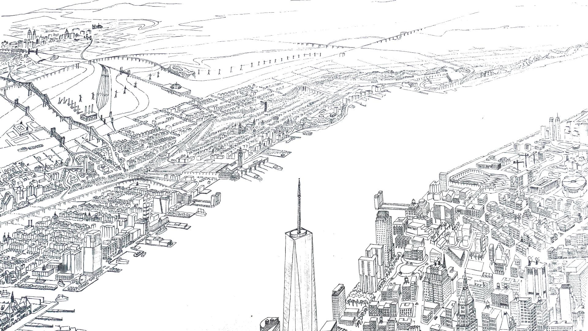
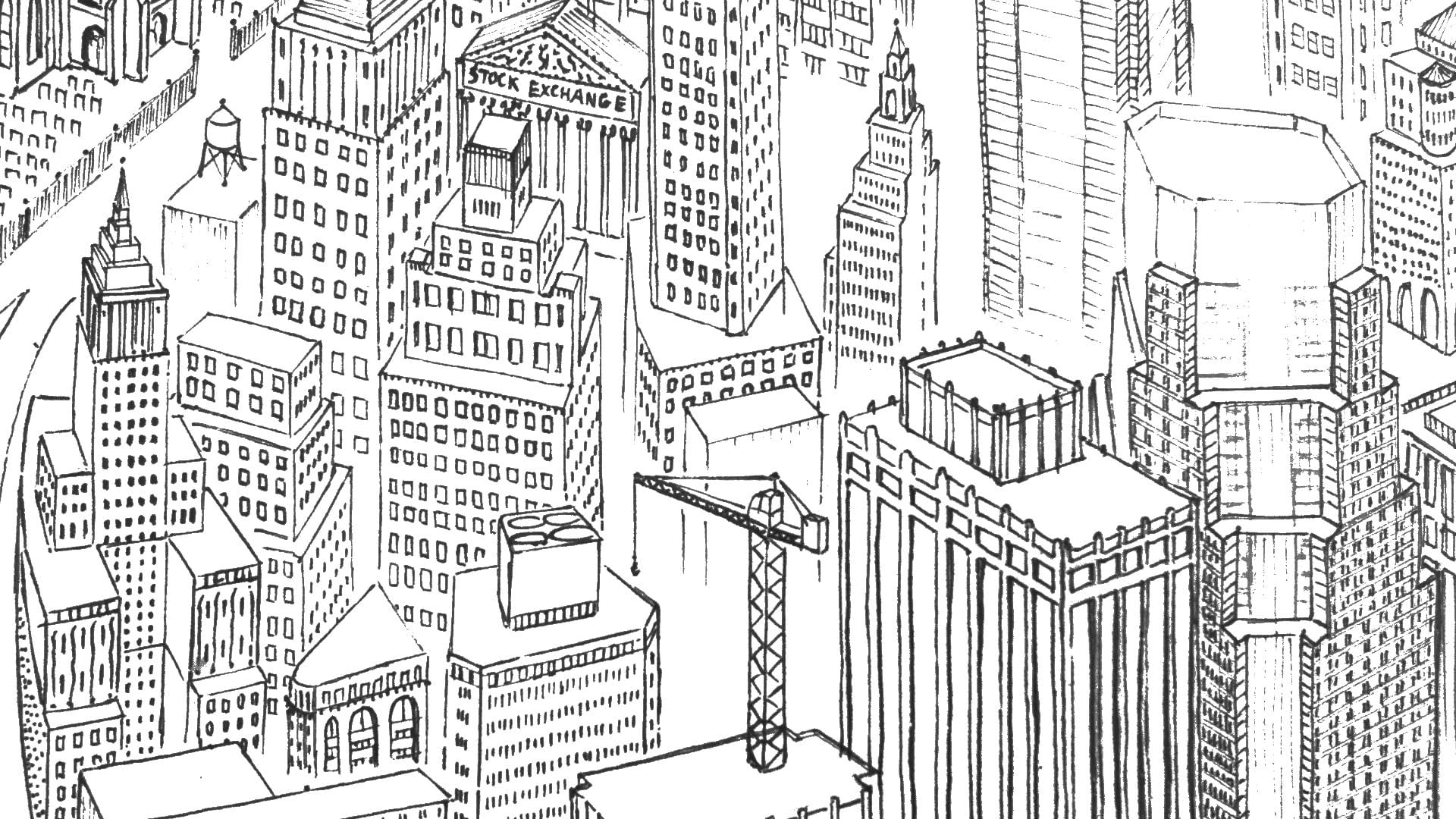
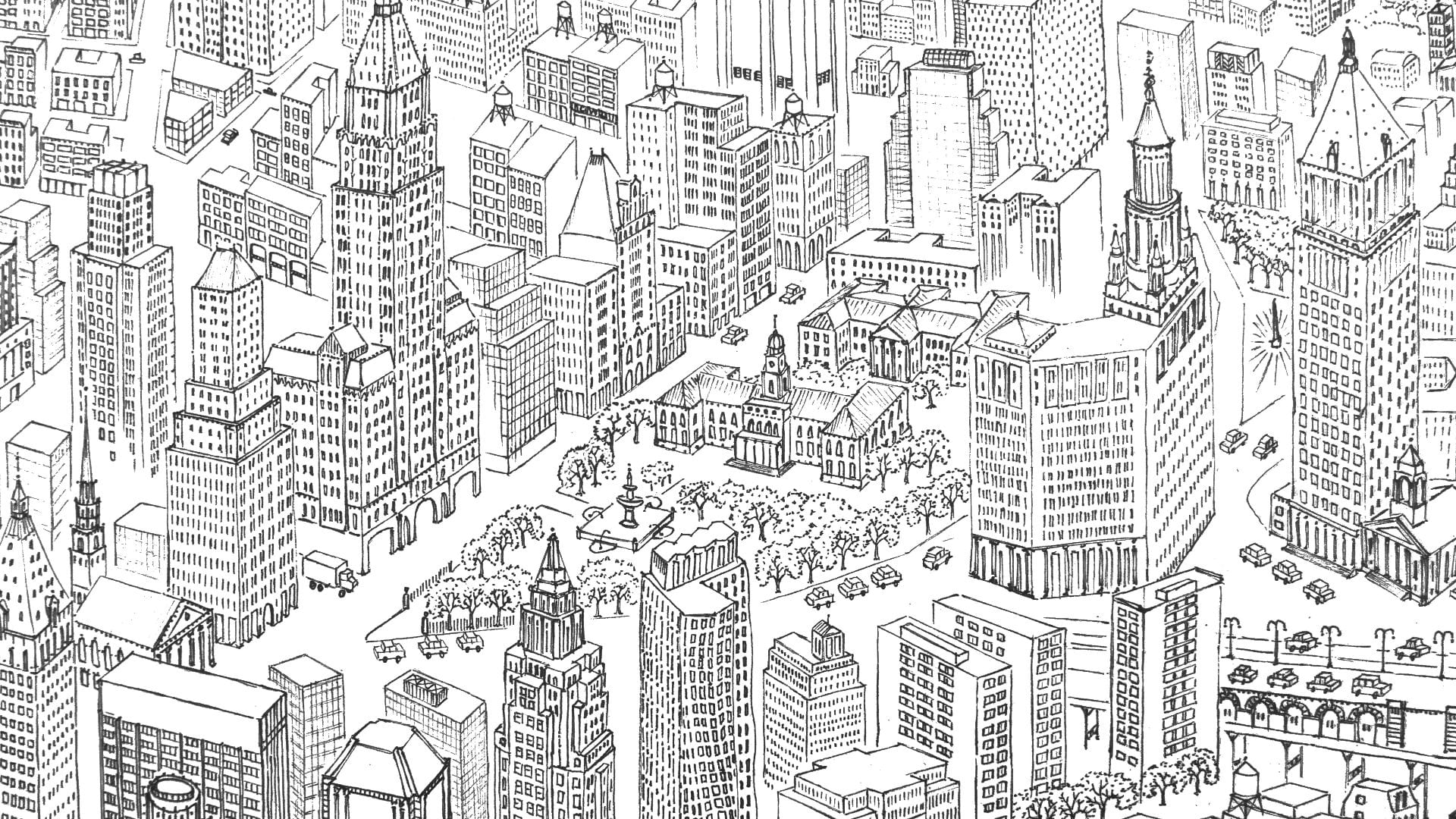
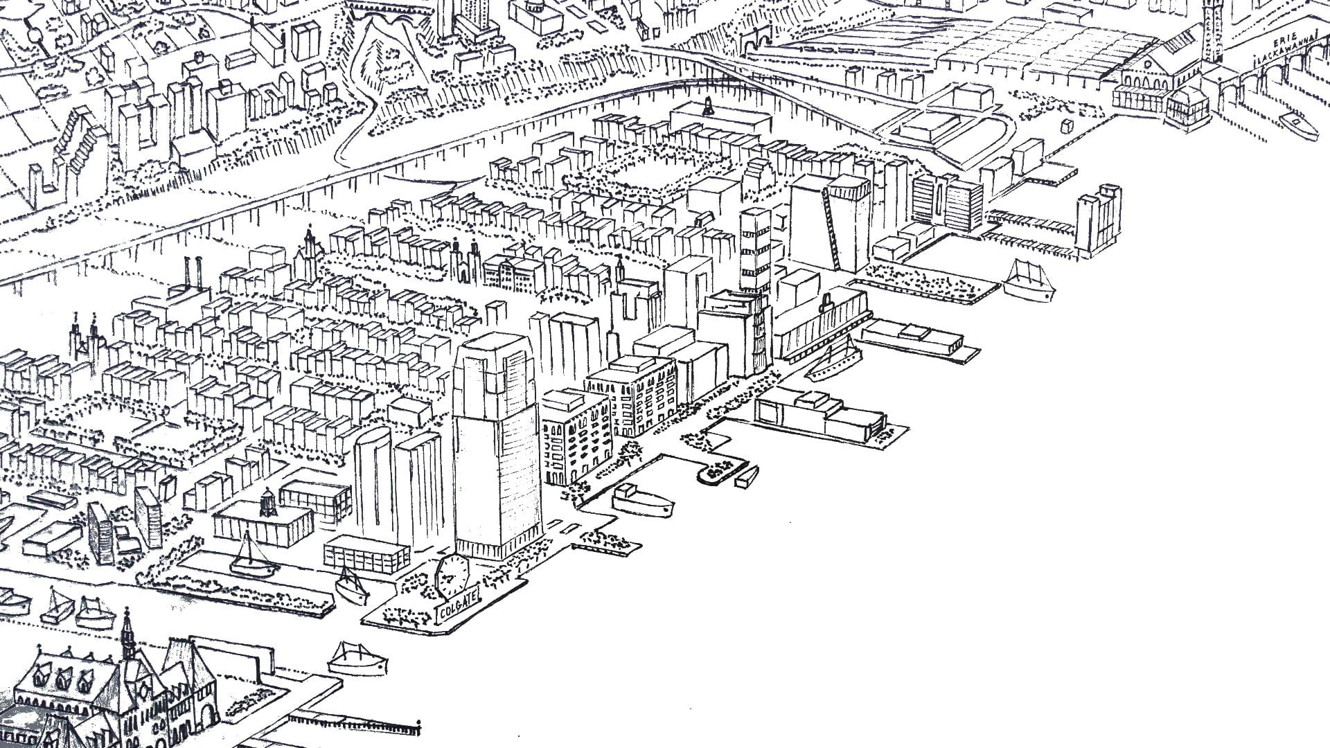
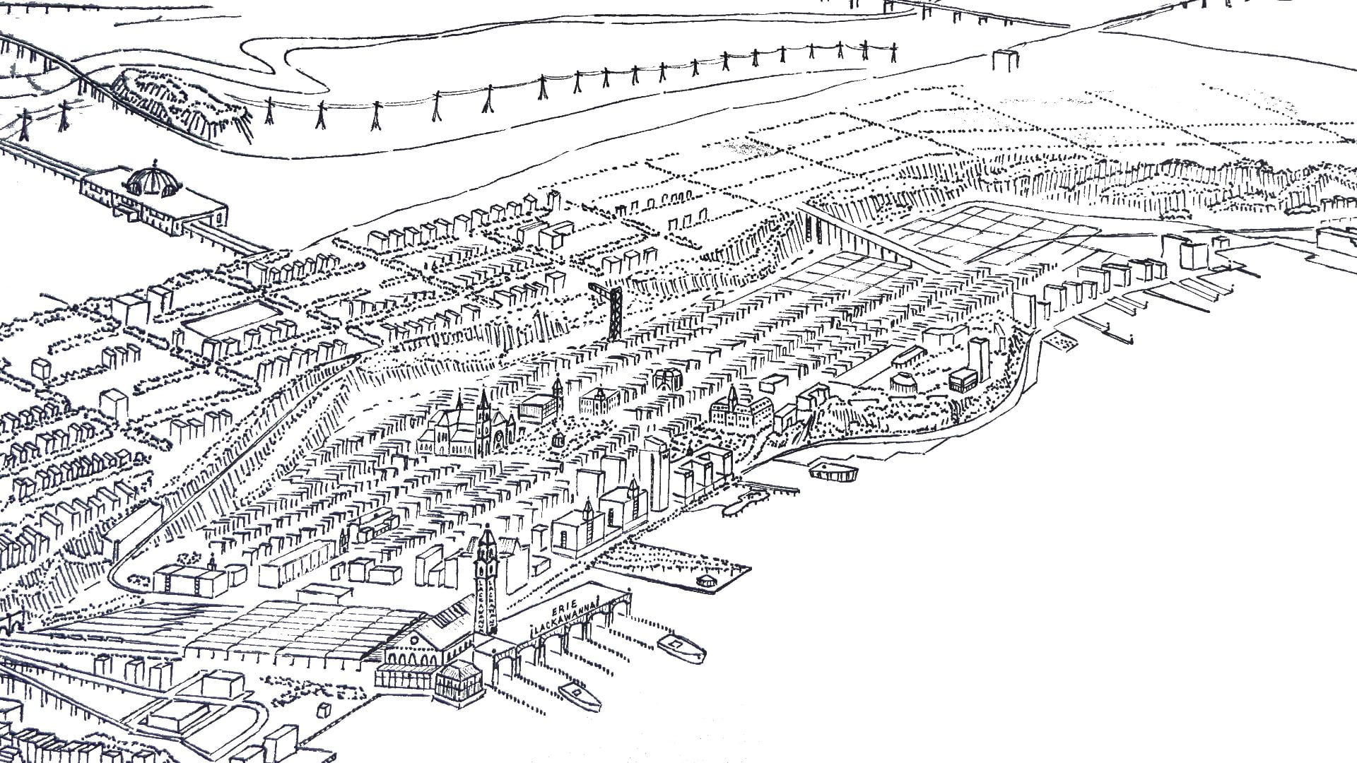
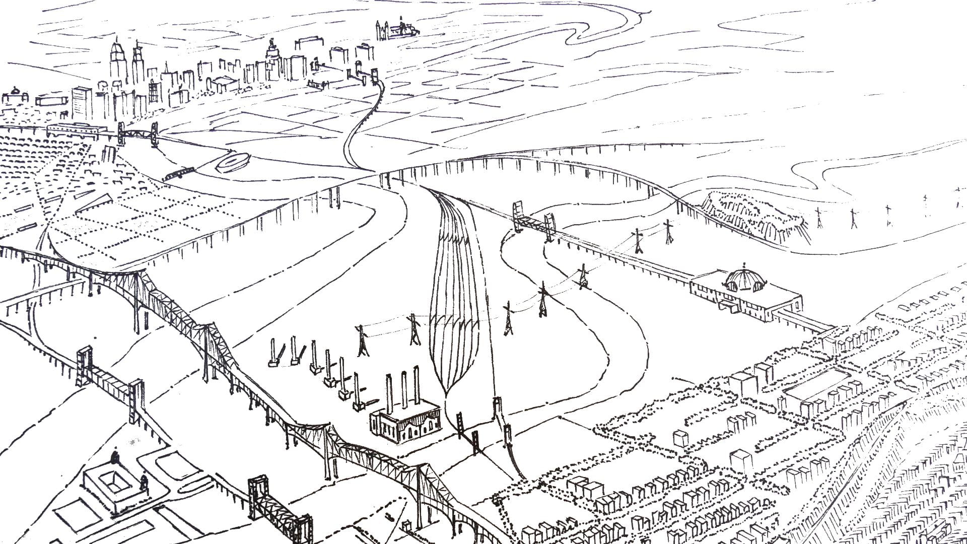
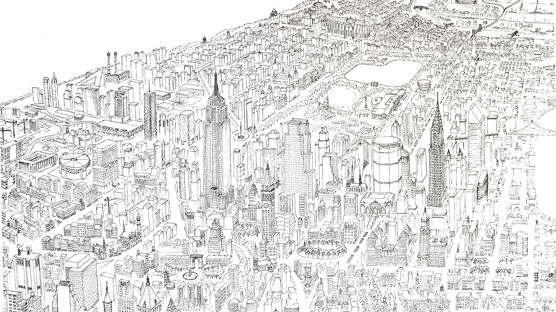
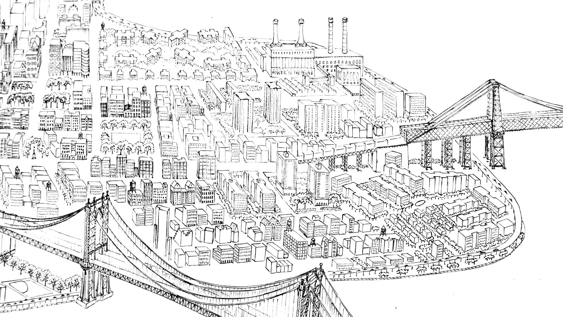
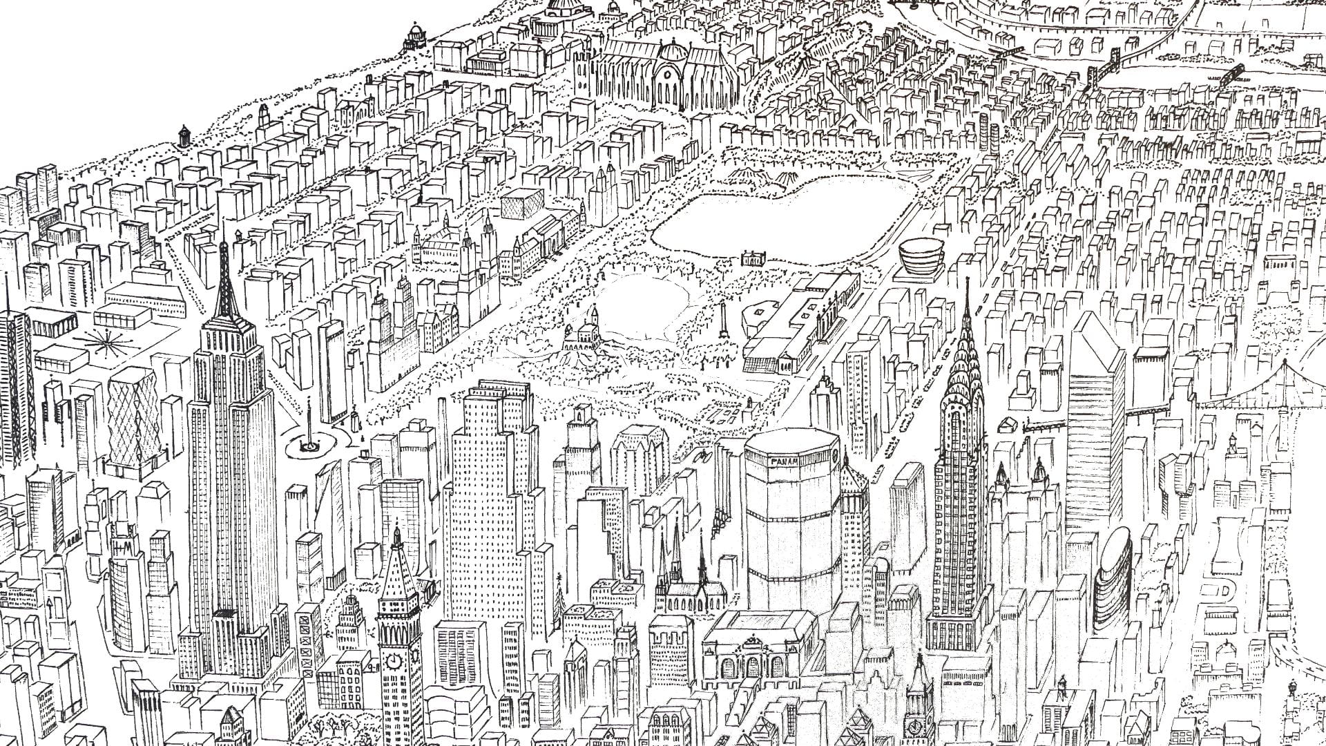
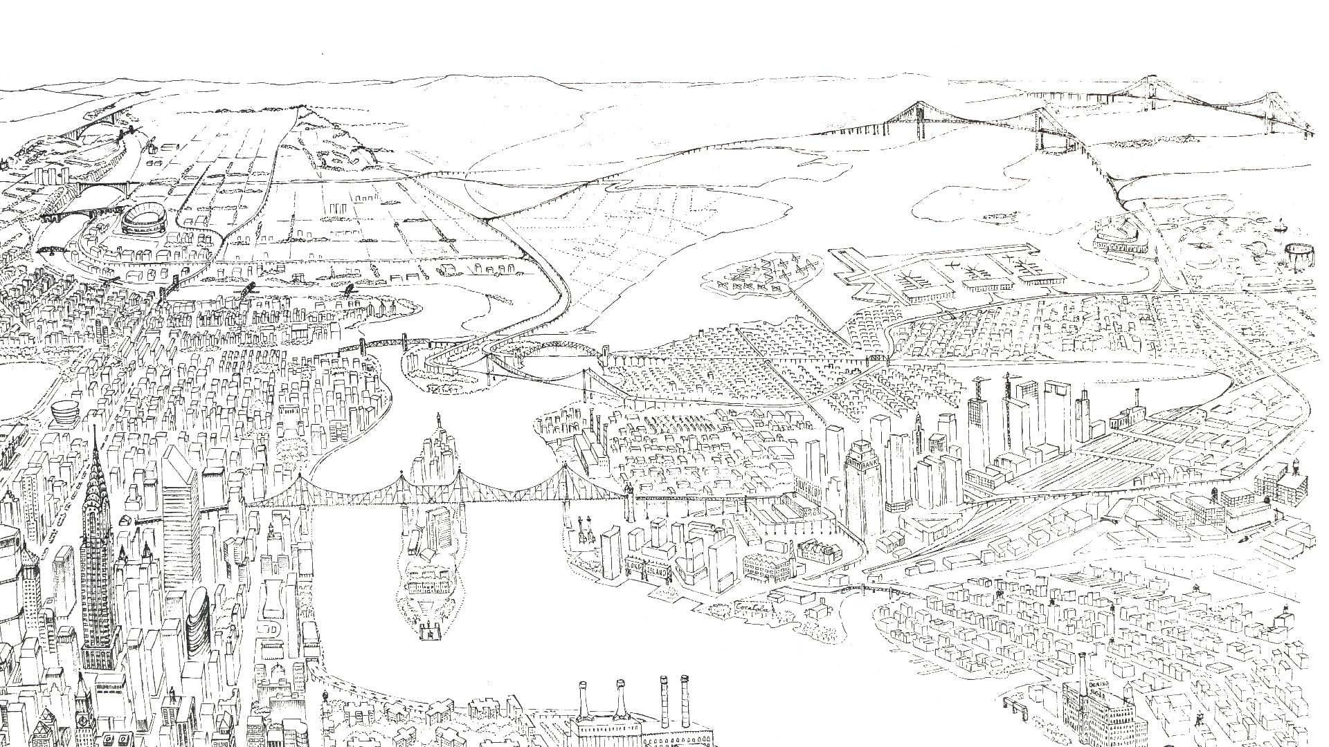
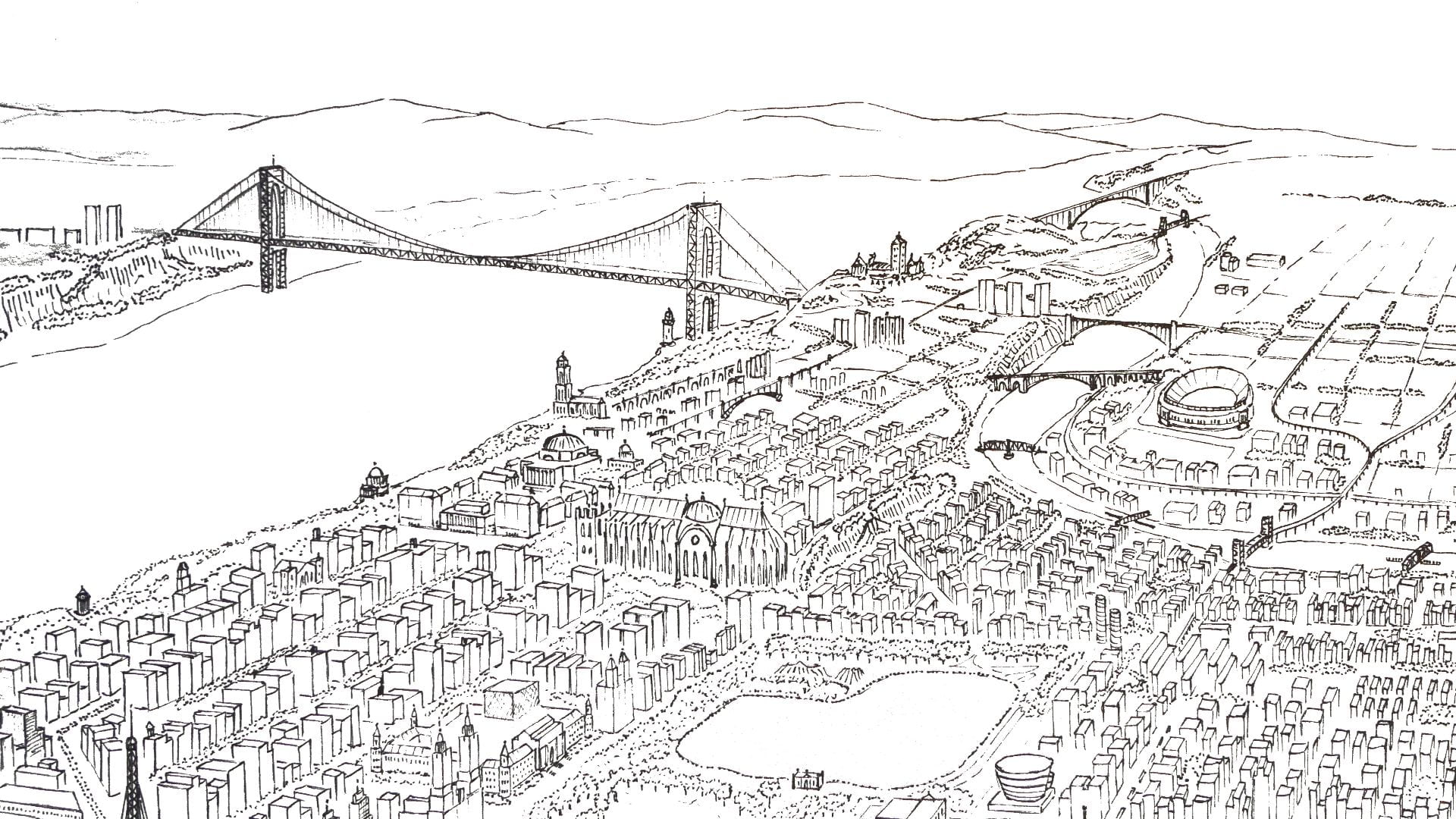
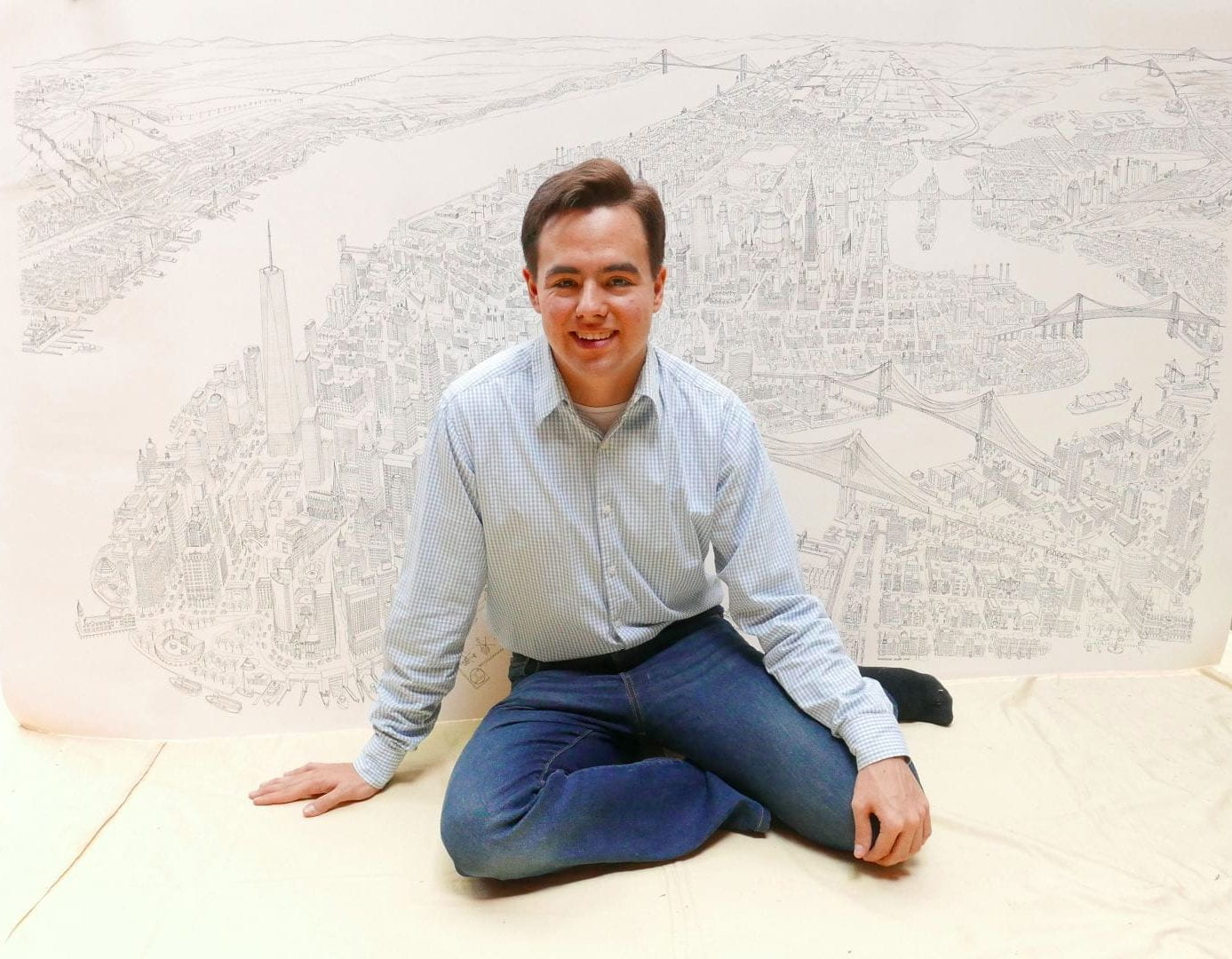
This ink on paper drawing represents 800 hours of work over several months. The dimensions are 45 inches high by 79 inches wide (114 cm by 201 cm).
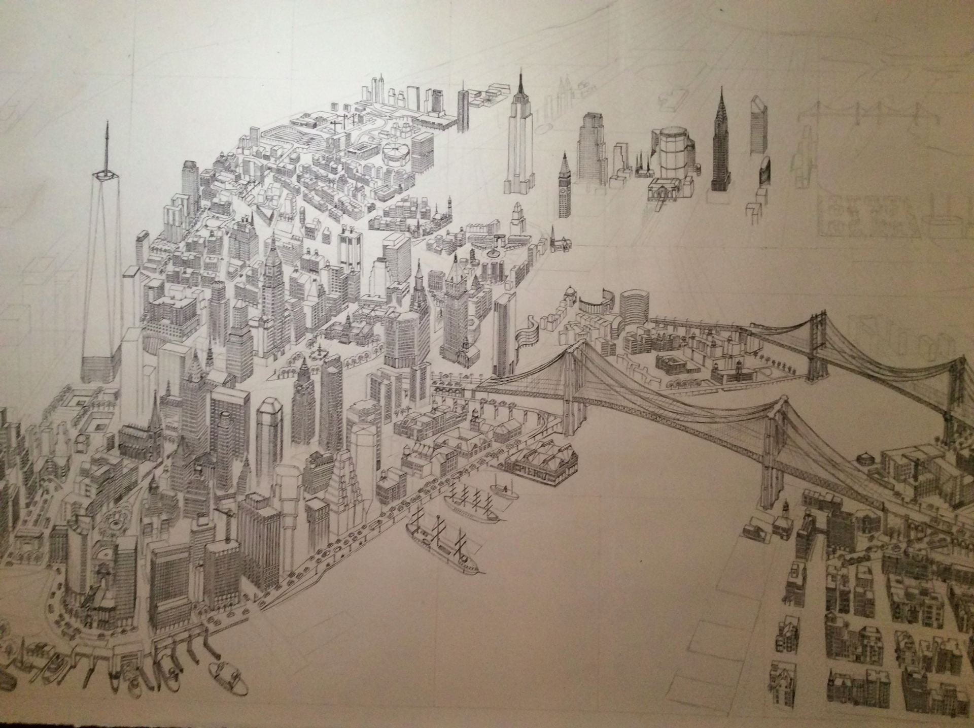
This panorama shows NYC looking northwest from above Governor’s Island and Red Hook. The Statue of Liberty, Ellis Island, and Staten Island are outside the frame. The view is accurate as of summer 2017 and does not include buildings built after this time.
View on Google Earth where this image is taken from.
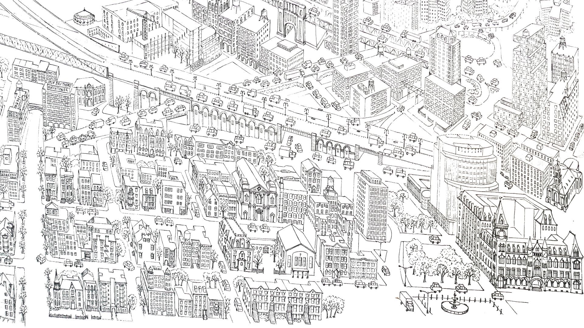
The image features ~4,493 buildings. For the largest and most important buildings, more attention is paid to detail. All of Manhattan’s bridges and major parks are included. Any buildings excluded were done so because they were either too small, too distant to include, or not visible from the angle this image is taken.
Image Inventory
● 1,769 buildings in Manhattan
● 436 buildings in Brooklyn
● 1,072 buildings in Queens
● 76 buildings in Bronx
● 1,140 buildings in New Jersey
● 9 construction cranes
● 25 water features
● 28 churches
● 47 ships
● 56 bridges
● 74 water towers
● 348 cars
One metropolis
5,080 features of the built environment shown
What was the most difficult part?
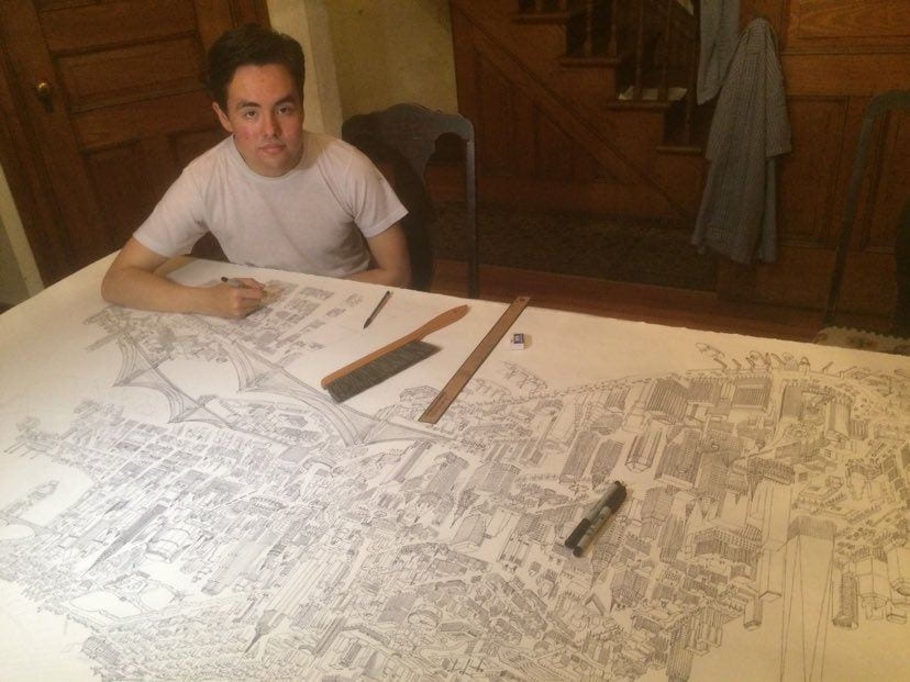
Because the image is ink on paper, there is no way to erase a mistake. At the later stages, any slip of the pen might have destroyed several months of work.
I am delighted with the result, but the process was tedious and required drawing thousands of windows during the pandemic in 2020. I never counted how many. I could only work a few hours per day before becoming exhausted. I will never attempt a drawing like this again because it is so time-consuming, and I am unlikely to ever find myself trapped again at home for such a long period of time during the pandemic lockdown. Fortunately.
What gave me the idea for this project?
My goal in ten years is to research and teach about art history and urban studies. Unfortunately, most aspiring professors do not get to choose the city where they work. Because I might not have the privilege of working near New York City, I wanted to draw a keepsake of all my youthful memories and experiences here. I have a photographic memory walking through the city. So I have memories that relate to all the buildings shown. I plan to frame this on the wall above my desk.
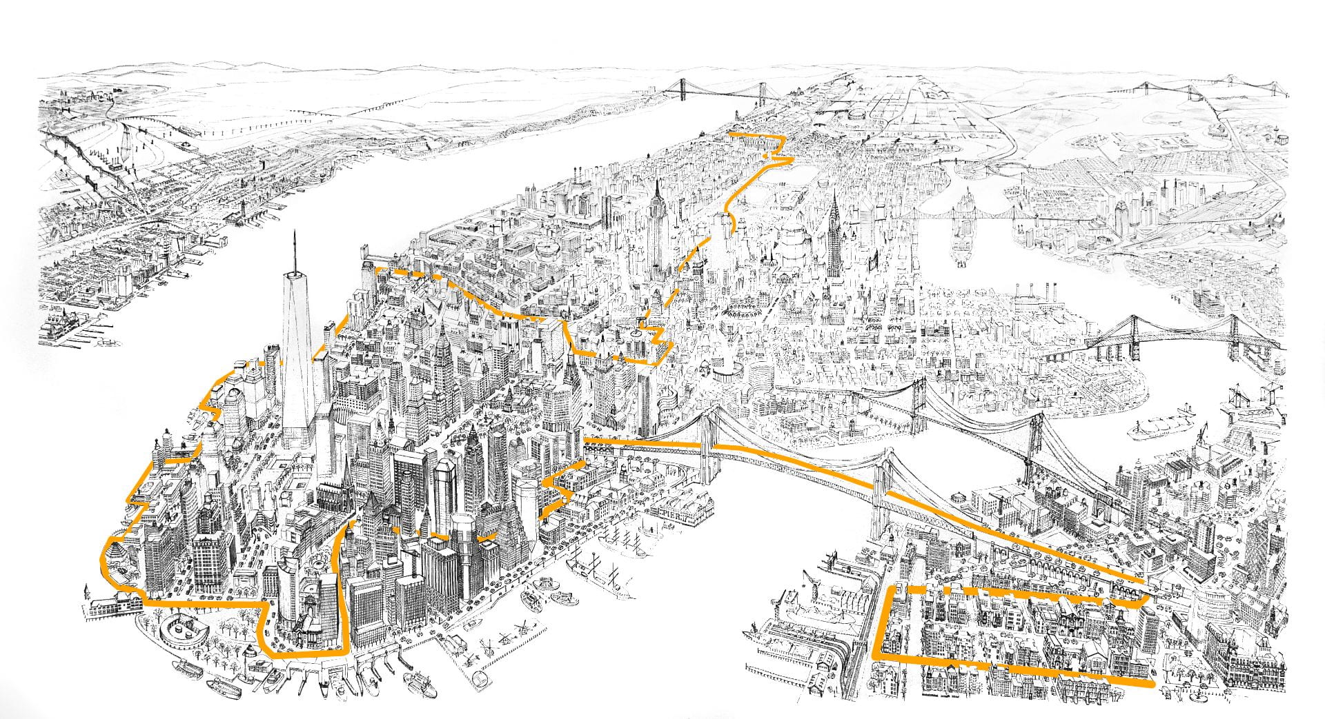
Riding Professor Kenneth Jackson’s all night bike tour through Gotham’s history inspired this image. Traced in orange below is the route of Jackson’s bike tour: starting at Columbia University’s Low Library, through Central Park, across Midtown to Washington Park, along the Hudson River to Wall Street, and then across the Brooklyn Bridge.
Annotated Map
Click red label to view detail area in detail.
Wow, this is awesome!
What a monumental undertaking. Kudos to you!
Absolutely incredible! What a labor of love.