• This website includes dozens of videos, hundreds of essays, and thousands of drawings created over the past twenty years. Search to learn more about the history of buildings, places, prisons, Newark, New York City, and my PhD research on spatial inequality.

  • Or scroll down for the latest publications.

A Different Kind of Radiant City: Bucharest

Comparing Le Corbusier’s plans for Paris with Ceaușescu’s plans for Bucharest

.

.

Abstract: Comparing Le Corbusier’s unrealized plans for Paris and dictator Nicolae Ceaușescu’s completed plans for the Romanian capital Bucharest reveals similarities in their urban forms. Analysis of three features in both cities – their nineteenth-century urban forms, the integration of twentieth-century plans into the existing urban forms, and the political symbolism of each plan – reveals the two places as reflections of each other. The comparison matters because it establishes an unconscious aesthetic link between the progressive (almost utopian) urban designs of an architect like Le Corbusier and the repressive (almost dystopian) urban designs of a dictator like Ceaușescu.

.

Utopia and totalitarianism are both engaged in a mirroring game, tirelessly sending the same image back and forth as if utopia were nothing more than the premonition of totalitarianism and totalitarianism the tragic execution of the utopian dream. Only the distance that separates a dream from its realization seems to stand between the two.

– Frédéric Rouvillois
Utopia: The Search for the Ideal Society in the Western World [1]

.

Read More

.

Detroit Redlining Map in 1940

A data visualization of urban history and racializing space
Created with urban historian Robert Fishman

.

This map illustrates in three layers some of the impacts of a racist government policy called redlining:
  1. The base map shows the extent of street network development, as well as the locations of important industries, institutions, and urban features in 1940.
  2. The population dot map shows the areas where Black and Whites lived in the segregated city.
  3. The redlining map shows the areas where government and banks chose not to invest, and to therefore deprive people living there of homes.
All three features – the physical city, the urban residents, and the urban policy of redlining – are interlinked. By displaying these three features together, previously invisible aspects of urban history become visible in plain site to the public.

.

.

View project full screen

Opens in new window

.

Data sources:

Topoview from USGS for street network maps
Mapping Inequality Projecct for redlining data
IPUMS at the University of Minnesota for population and race by census tract

.

Created with help from:

Robert Fishman academic mentor
Karl Longstreth from the Clark Map Library at the University of Michigan
Gergely Baics and Wright Kennedy from Columbia History Department
whose project about racializing space in New York City inspired this proposal

“The State is Responsible”

Racial Segregation in Royal Oak Charter Township and Detroit Public Schools, a Comparative History

Written with urban historian Robert Fishman

.

Black children standing in front of half-mile concrete wall, Detroit, Michigan. This wall was built in August 1941, to separate the Black communities of Royal Oak Township / Eight Mile-Wyoming from a White housing development going up on the other side.

.

“Education, then, beyond all other devices of human origin, is the great equalizer of the conditions of men [and women] – the balance-wheel of the social machinery.”

– Horace Mann (1796-1859) promoter of free public education for all

.

If an educated public is necessary for democracy to function, then the strength of our nation’s public schools predicts the strength of our democracy. This observation would seem to be obvious and universally agreed, but in many parts of America it is not. Only seven percent of students in Detroit public schools read at or above their grade level when compared to children from neighboring suburbs. In Detroit metro, forty-seven percent of people are functionally illiterate as of 2017; the large majority are Black. These low levels of even basic literacy exist in thousands of places across the United States, not just in Detroit. In large part, this is the result of urban policies that assume that race should determine the quality of public services the state provides. An autopsy of how and why America came to be this way deserves several books and traces back several centuries. Instead, this article will analyze race-based policies that excluded Blacks from well-funded public schools in just one Detroit suburb: Royal Oak Charter Township.
First, the legal background is presented of Milliken v. Bradley, a key case before the U.S. Supreme Court in 1974 that shaped metro Detroit’s current system of school segregation. Second, the historical case study of Royal Oak Charter Township is introduced: how this township came to be and why its present existence is a continued legacy of state-sanctioned racism. Third, the history and present problems of Royal Oak Township are reflected in its failed school system. The case of Royal Oak Township is also situated in the larger context of Detroit and is linked back to Milliken v. Bradley.

.

Read Full Article

Opens as PDF in new window

Branch Brook Park Interactive History Map

As featured by the Branch Brook Park Alliance as the official park map

.

Navigate this interactive history map of Newark’s Branch Brook Park. Click on map features to learn about park amenities, recreational spaces, and historic features. Map annotations are paired with explanatory texts and comparative photos of past and present. Beneath each annotation is the Google Maps link that will display directions to that point in the park from wherever you are standing.
All historic images are from the archives of the Essex County Parks Department and Newark Public Library. Browse their digital collections or contact the agency to visit their archives. All descriptions are sourced from the Cultural Landscape Report that documented the park’s history and renovation.
Map created by Myles Zhang
Map texts by Linda Morgan, Curtis Kline, Myles Zhang, Maeher Khosla, and Jack Barron
Contemporary photos by Curtis Kline with Mouli Luo

.

Read More

.

Warren Street School Demolition

As featured in:
1. Darren Tobia for Jersey Digs

2. The Vector, NJIT’s student newspaper
3. Read my analysis of campus architecture for some context on this demolition.

.

.

“Those historians want to keep these old bricks. I can’t see why you’d want that s**t. F**k it. We might just slip in some new bricks. You can’t tell the difference anyway.”

– Conversation overheard between demolition workers at the Warren Street School

.

.

.

“The university has never demolished any historic building of any value. Name one.”

– President of the university during a community meeting in October 2020

.

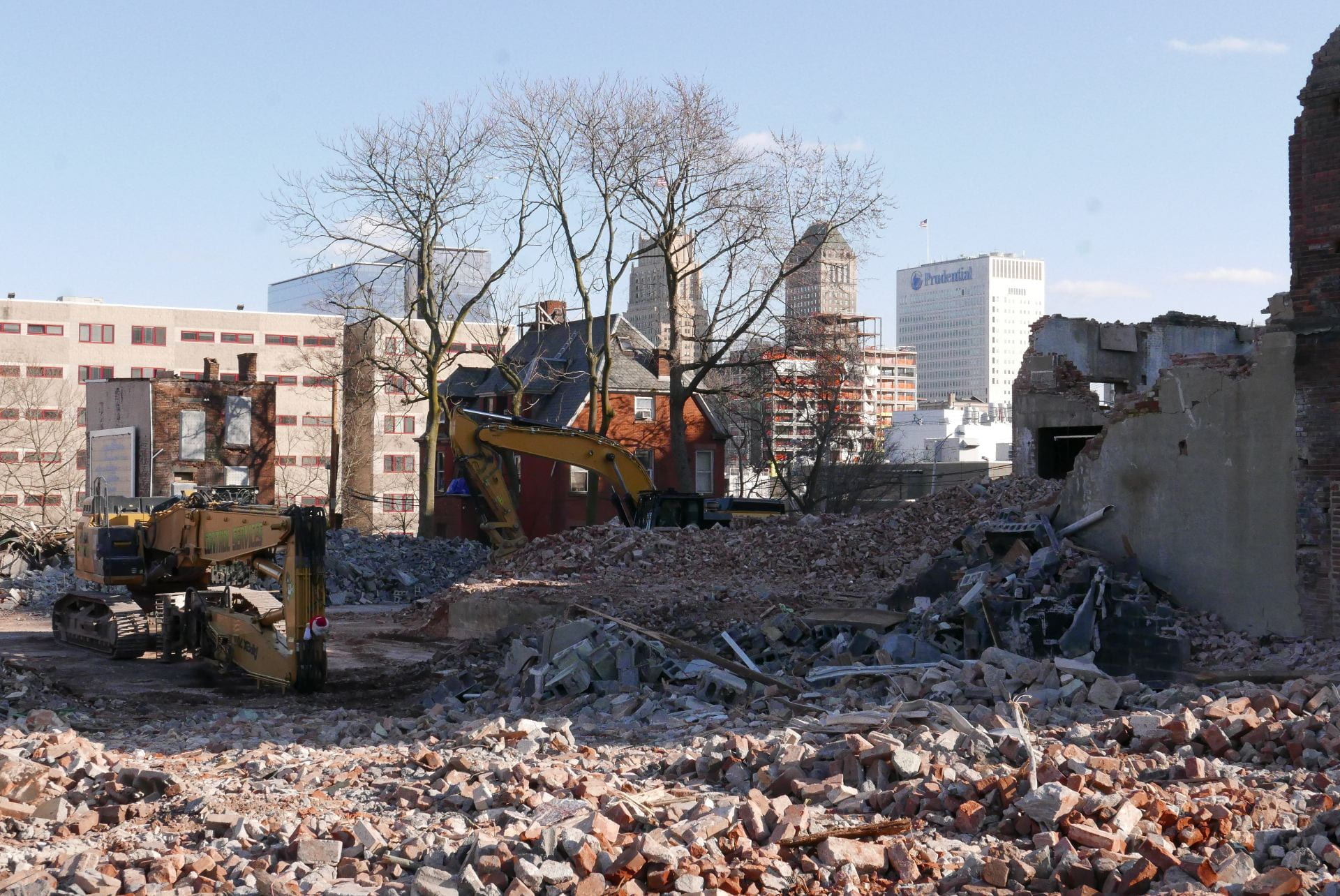
When walking past the historic Warren Street School in spring 2021, a demolition scene by the local university shocked me. The building had been nominated to the National Register of Historic Places, together with five other Newark school buildings. Therefore, the drastic destruction should have been under state and local reviews. But demolition was approved on April 1, 2021, on April Fools Day.
The 150-year-old school was built by Jeremiah O’Rourke, the Supervising Architect for the U.S. Treasury Department and the architect of Sacred Heart Basilica and some of the largest civic structures in 1890s America. Before the university acquired the building in salvageable condition, it was the home of American History High School, founded by beloved Professor Clement Price to promote learning of American and local history by coming generations. Even with its windows now stripped out and demolition equipment parked around it, the grand master work for Newark’s proud history of public education was crying for this painful end delivered by the wanton and shameful act of university leadership.
At the orders of the university president, a short-sighted acceleration of demolition around the campus in the country’s third oldest major city has been savagely damaging the city’s history. These actions add to the list of hundreds of buildings already demolished in the area. While institutions like Rutgers and developers like RBH and the Hanini Group have embraced historic preservation, this university still insists on wiping the slate clean of history that it views not as an asset but as an inconvenience.

.

.

The future of any great institution depends on the preservation and appreciation of its own history. I believe in saving old buildings not just because they are pretty. More than an argument for historic preservation on aesthetics alone, history – and the visible presence of history – shapes our appreciation for the sacrifices of those before us. Passing by the Warren Street School for twenty years, I thought every time of the thousands of immigrant children who attended school here for over 170 years uninterrupted. I thought of the Irish and Italian brick masons who carved the school’s terracotta ornaments by hand on wages of 5 and 10 dollars a day. I thought of these children’s parents, who came to Newark by steamship and steam engine to give to their children a better shot at life than they could ever dream of. I thought of the architect who built this building in the 1880s with care and love and hope that better civic architecture will produce better citizens.
It is the burden of history that shapes us, and it is on our commitment (or failure) to interpret and enrich history for the next generation on which each of us will be judged. I am reminded of architectural critic Ada Louise Huxtable’s words in 1963 when she described with horror the demolition of New York Penn Station.
“Until the first blow fell no one was convinced that Penn Station really would be demolished or that New York would permit this monumental act of vandalism against one of the largest and finest landmarks of its age of Roman elegance. Somehow someone would surely find a way to prevent it at the last minute – not-so little Nell rescued by the hero – even while the promoters displayed the flashy renderings of the new sports arena and somewhat less than imperial commercial buildings to take its place.
“It’s not easy to knock down nine acres of travertine and granite, 84 Doric columns, a vaulted concourse of extravagant, weighty grandeur, classical splendor modeled after royal Roman baths, rich detail in solid stone, architectural quality in precious materials that set the stamp of excellence on a city. But it can be done. It can be done if the motivation is great enough, and it has been demonstrated that the profit motivation in this instance was great enough.
“Monumental problems almost as big as the building itself stood in the way of preservation; but it is the shame of New York, of its financial and cultural communities, its politicians, philanthropists, and planners, and of the public as well, that no serious effort was made. A rich and powerful city, noted for its resources of brains, imagination and money, could not rise to the occasion. The final indictment is of the values of our society.
“Any city gets what it admires, will pay for, and, ultimately, deserves. Even when we had Penn Station, we couldn’t afford to keep it clean. We want and deserve tin-can architecture in a tin-horn culture. And we will probably be judged not by the monuments we build but by those we have destroyed.”

.

.

.

.


.

.

Learn from the past.
Live in the present.
Plan for the future.

This was the inscription mounted at the Warren Street School’s entrance, which demolition cranes tore off and crushed in the dumpster. A site that once had a past, now has no past to learn from and to inform the present and future. Through demolition, our link with history is severed.

Bulldozer Urbanism

As featured in:

1. Preservation New Jersey: Ten Most Endangered Historic Places  May 18, 2021
2. After Warren Street School Demolished, James Street Named ‘Most Endangered’  May 18
3. Newark Historic District Designated as Endangered  May 18, 2021
4. James Street Community Rushes to Stall NJIT’s Demolition of Historic School  May 6, 2021
5. Nothing Lasts Forever, Not even at NJIT   February 1, 2021
6. SHPO Delays NJIT’s Plan to Raze 4 Historic Buildings    January 8, 2021
7. NJIT’s Plans to Demolish Buildings in Historic District Temporarily Derailed   January 7, 2021
8. Old Jail Could Inspire Youth to Stay Out of Prison – But Only If It Survives   July 4, 2020
9. NJIT’s Plans to Modernize Its Campus Could Cost Newark Some History   March 12, 2020

.

James Street Commons demolitions completed and proposed as of April 2021

.

Note: Visiting NJIT’s architecture school at age six and seeing students working there was what initially inspired my desire to study architecture. NJIT is an asset to Newark, and the school deserves the quality of campus architecture to match. I wrote and circulated this essay about NJIT’s under-performing campus design to members of NJIT and the Newark community. I am sharing it online, too, in the hope that future leaders of NJIT will collaborate with the community to create campus architecture that is culturally and historically sensitive to Newark.

.

A Pedestrian’s Observations

Experiencing NJIT’s campus from the street

In publicity materials and in meetings with Newark residents and historians, the New Jersey Institute of Technology emphasizes the quality of its campus architecture and its track record of historic preservation. The school highlights its Central King Building (formerly Central High School) and Eberhardt Hall (formerly Newark Orphan Asylum) as trophies of historic preservation.
However, beyond its fortified campus carved out during the 1960s era of “urban renewal,” the university is now escalating its demolitions in the neighboring James Street Commons Historic District. Listed since 1978 on the National Register of Historic Places, this neighborhood is the city’s first historic district and contains some of Newark’s most significant historic assets. The spending of millions of dollars on building demolitions is odd when NJIT faced a 35 million dollar budget deficit in the first half of 2021,[1] and when other Newark institutions and developers are following an opposite path of historic preservation.
As NJIT expands into the James Street Commons Historic District, there is concern that new construction will not improve the built environment. For instance, NJIT’s proposal for 240 MLK included few to no windows at pedestrian eye level. The entrance to the parking garage and trash collection was from the side of the building that faced toward the residential neighborhood. Several other structures in the neighborhood are also at risk or have already been demolished by NJIT, such as Mueller’s Florist, which was a former corset and tin toy factory built in the 1880s to 1890s. Similarly, NJIT acquired the c.1890 brownstone at 317 MLK for ~$450,000 in livable condition. In following weeks and months before NJIT received demolition approvals, windows were left open and removed, thereby accelerating decay and water damage. The current demolitions follow a longer pattern among hundreds of other buildings demolished in my neighborhood. This would all be okay if only there was better quality architecture to replace what is being lost.
I write this essay as a series of architecture observations followed by recommendations. Firstly, I provide examples of how NJIT’s current campus design is detrimental to neighborhood street life. Secondly, I document the neighborhood’s appearance before and after NJIT’s interventions through my photo comparisons of past and present. Thirdly, I provide examples of more sensitive models for alternative neighborhood redevelopment.

.

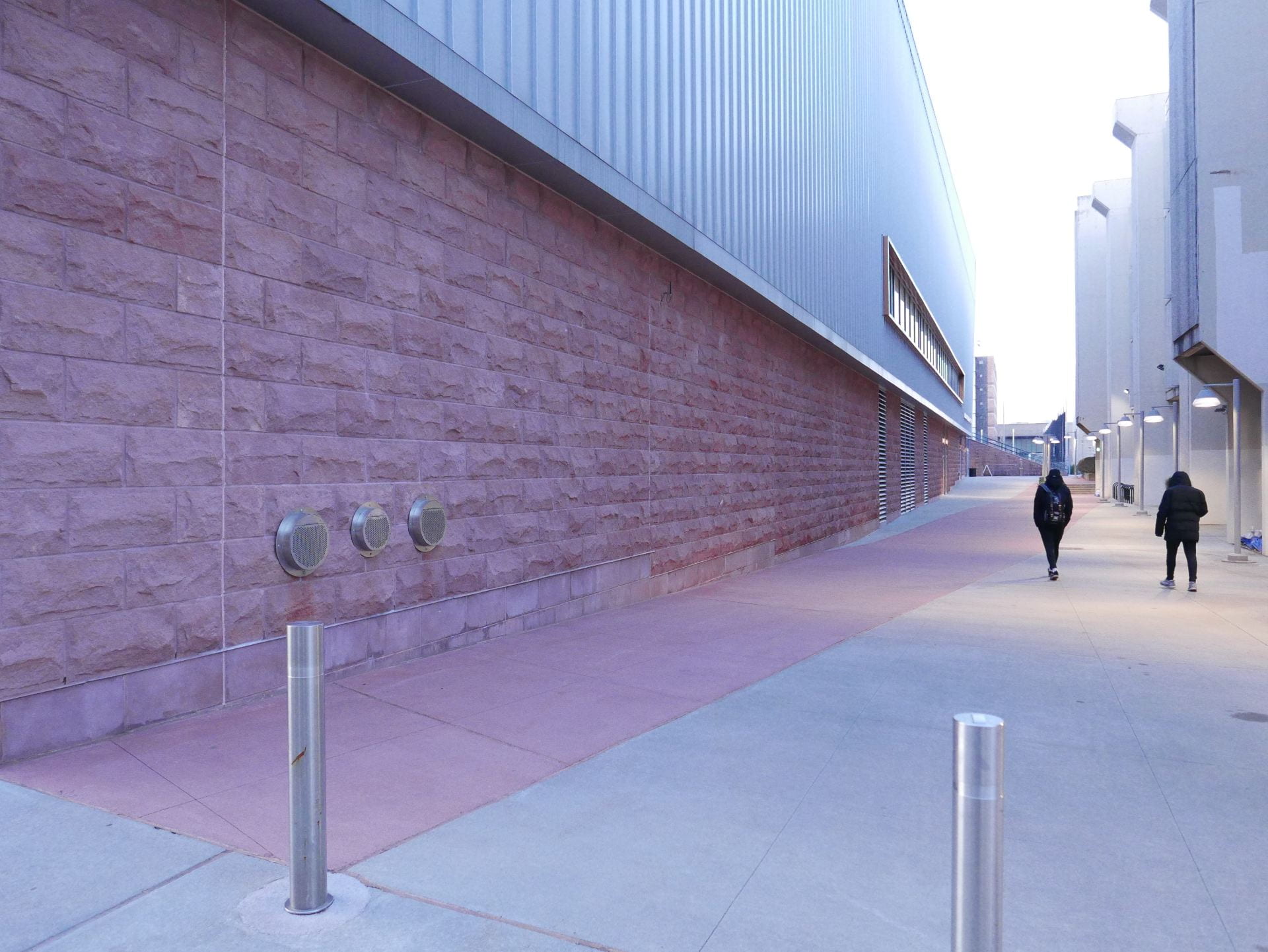
Completed in 2017, NJIT’s athletic facility is the newest building on campus.
The pedestrian view along the sidewalk has no windows.

.

Demolition of the 140-year-old Bowers corset factory in progress (aka Mueller’s)

.

Map of NJIT campus. Buildings that face toward the street with no windows at or near eye level are indicated with red lines. Surface parking lots and parking structures for commuter students and faculty are indicated with red squares.

Read More

.

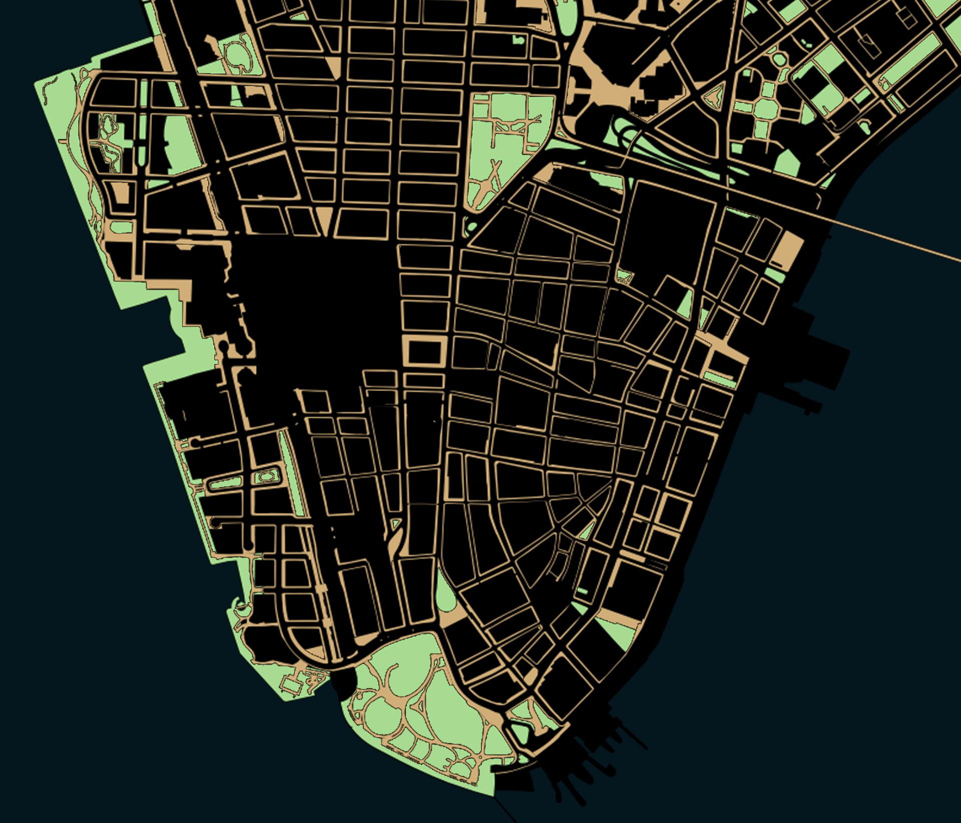
The Privatization of Public Space in Lower Manhattan

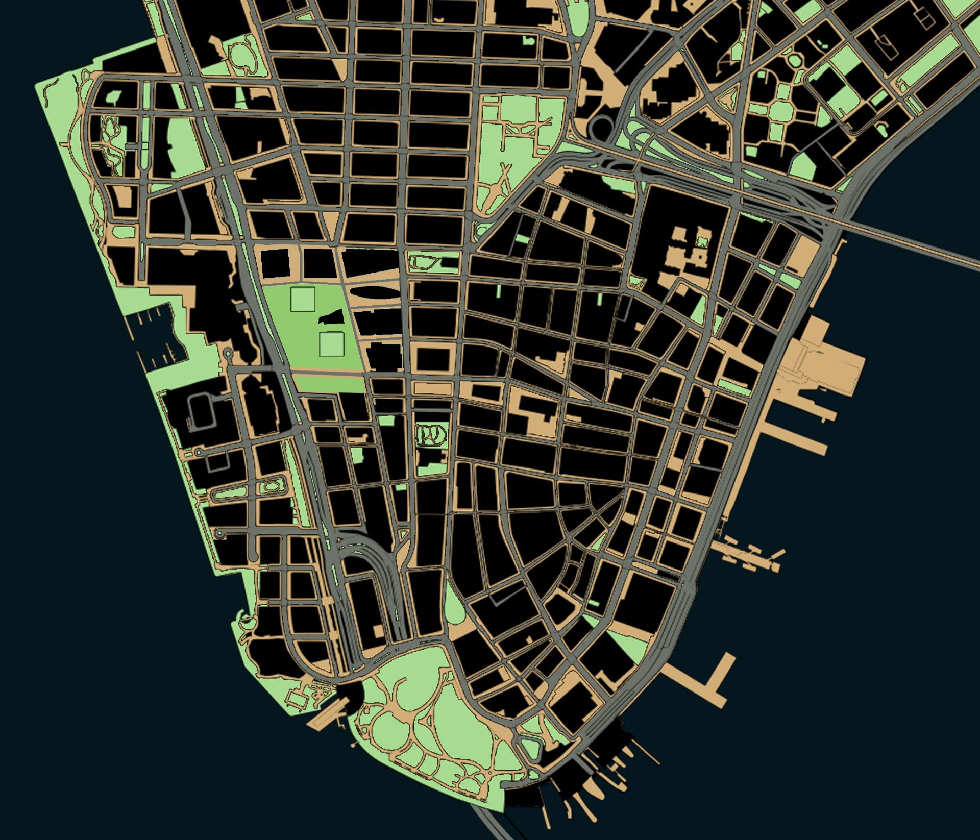
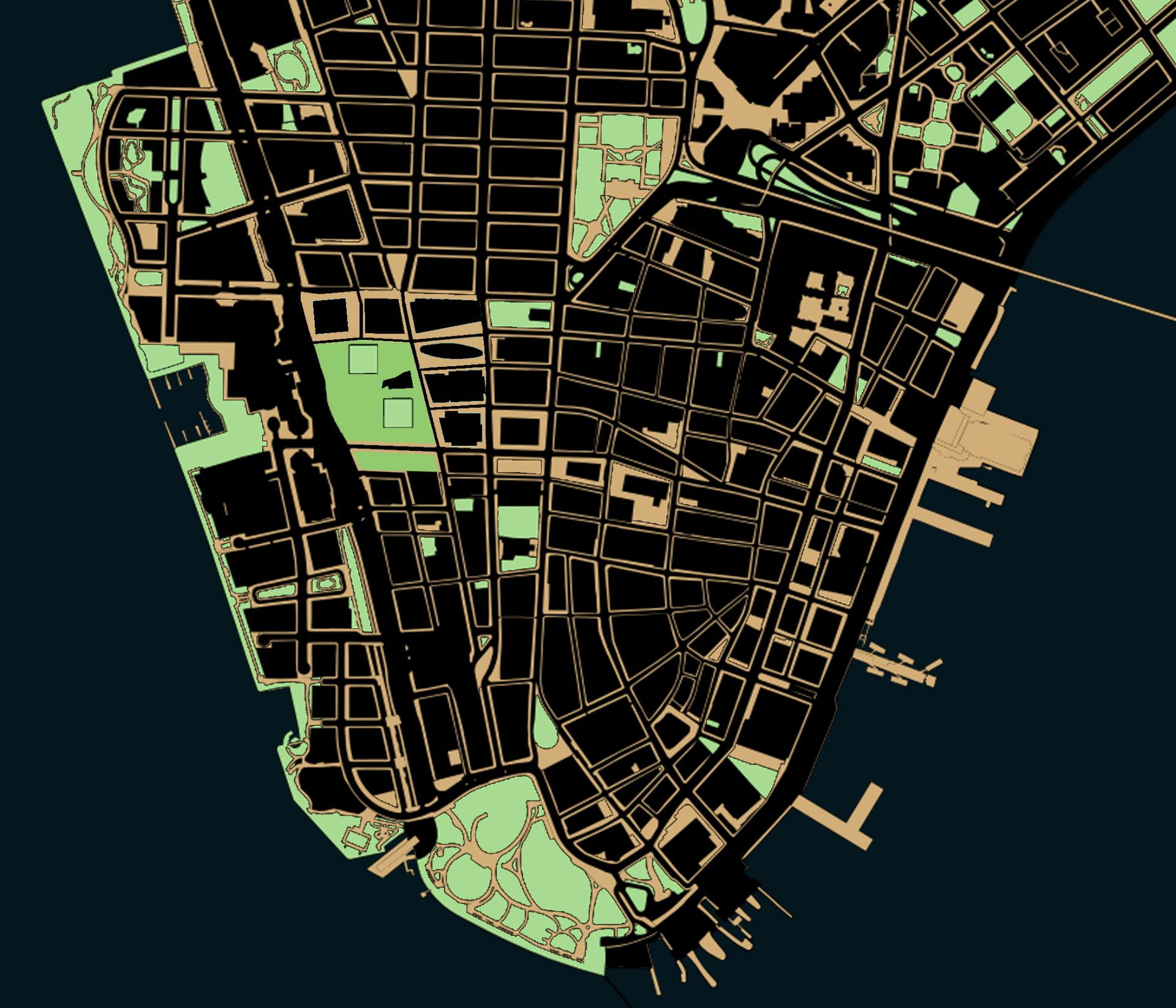
Map created by author in QGIS with planimetric data from NYC Open Data

.

More than a specific threat to New York City, the decades-long erosion of public space is an existential threat to democracy.

About 60% of Lower Manhattan’s surface area is listed as being public in some way, but only about 25% is totally unrestricted to the public in practice.*1

.

New York City – and the world’s wealthiest corporations headquartered in Lower Manhattan – had much to do with inventing and spreading new technologies that influenced the urban form. Construction companies like US Steel at 165 Broadway supplied materials for the highways that sliced through cities. Car companies like Chrysler in Midtown encouraged America’s affair with gasoline. Groups like Chase Bank at 28 Liberty Street supplied home loans for whites-only suburbs. Stores like Woolworth at 233 Broadway helped replace small businesses on main street with one-stop department stories and suburban shopping malls. Above them all, the New York Stock Exchange at 11 Wall Street supervised the twentieth-century migration of wealth and capital from American industrial cities to foreign countries with cheaper labor. These changes might have started with the “titans of industry” perched in Lower Manhattan’s skyscrapers, but highways, cars, home mortgages, shopping malls, and de-industrialization all had consequences for the rest of us. This makes Manhattan the ground zero – and in more ways than just September 11 – to understand the forces shaping the loss of public space.
Over the past century, three forces in Lower Manhattan have been chipping away at the quantity and quality of public space: the car, the corporation, and the police state. Each of these three forces effected Lower Manhattan in particular and the nation at large. Each of these three forces, prompted by changes in technology, reshaped the urban form: 1) the invention of the affordable and mass-produced car that substituted for public transit; 2) the abandonment of cities for suburbs that was enabled by the car and encouraged by corporations; and 3) the invention of surveillance technologies to collect, store, and analyze data collected from public spaces. Each of these three technologies were, in turn, weaponized against the urban form to chip away at spaces that once belonged to society at large but which now belong to a select few. Each force will be analyzed in turn – the car, the corporation, and the police state – to reflect on the impact of each on Lower Manhattan’s urban form.

.

Public spaces in theory:
~60% of Lower Manhattan’s surface area

Read More

.

  1. * Percentages are rough estimates from author, based on area south of Chambers Street with planimetric data from NYC Open Data. An exact estimate is impossible to arrive at because there is no single definition of public space.

Street Grid Development vs. Population Density

Adapted from Shlomo Angel and Patrick Lamson-Hall’s NYU Stern Urbanization Project,
here and here.

.

The animation at left shows street grid development from 1801 to 2011, mapping Manhattan’s gradual expansion north. The animation at right shows the population density over time of each census tract in Manhattan. Notice how Manhattan’s population density rises and peaks around 1900 before falling to present levels. Despite Manhattan’s appearance of being denser and more built up with skyscrapers than ever before, the island actually has a lower population density than a century ago.

.

.

Before the introduction of subways in the early twentieth century, the difficulties of commuting distances over land and water drove a denser form of urbanism than today. By 1900, the island of Manhattan had over 2.3 million residents in comparison to only 1.6 million in 2020. These people were crowded into dense blocks with upward of half a million people per square mile. The subways had not yet opened, suburban sprawl had not yet arrived, there were no rail connections under the Hudson River, and Manhattan had few or no road connections with the other boroughs and the mainland. This produced an island of remarkable density with the Lower East Side the densest place on earth, while only a few miles north, Harlem remained almost rural.
In 1903, the Williamsburg Bridge over the East River linked the Lower East Side with undeveloped Brooklyn. The trolley lines, subways, and roadway that stretched over the Williamsburg accelerated the development of Brooklyn, first in the higher density parts of Brooklyn closest to Manhattan and later to the distant parts of Brooklyn and Queens with suburban population densities. Suburban growth started earlier than the 1950s image of Levittown, and with the movement of people outwards from Manhattan, the centers of immigrant cultural life shifted, too. In every following year, the Lower East Side lost people, arriving at a density in 2020 only a sixth of what it was in 1900.
Over the following decades, improvements in public transportation and the introduction of the car “smoothed” out the population density. At the same time, Manhattan’s street network expanded to cover the whole of the island from end to end. As the subways made commuting easier, people no longer need to live within walking distance of where they worked. As a result, many industries remained in Manhattan while their workers moved to other boroughs, and later still to the more distant suburbs. As a result, the population densities of Manhattan today are more consistent from one end of the island to the other. Unlike in 1900, Harlem today is about as dense of the Lower East Side because transportation has made one part of the island almost as accessible to work as any other part of the island.
This animation illustrates Manhattan specifically, but Manhattan’s growth and population densities were influenced by larger population and technology changes in the New York region.

The Detroit Evolution Animation

Created in gratitude to the University of Michigan’s PhD program in architecture
Related: The New York City Evolution Animation

.

Soundtrack: “Pruitt Igoe” from Koyaanisqatsi, directed by Godfrey Reggio and composed by Philip Glass.

.

This film traces Detroit’s evolution from its origins as a French trading post in the 1700s, to its explosion as a metropolis, followed by its precipitous decline as a symbol of America’s post-industrial urban landscape. The film weaves in details about the city’s politics, population, and technology – all of which influenced the city’s geography and built environment. At each phase in urban history, the built environment grew and was modified in direct response to political events like racial segregation, population changes like the Great Migration, technology developments like the mass-produced car, and government interventions like urban renewal.
The animation tells the story of Detroit specifically and the story of American cities more broadly. To varying degrees, the path of Detroit’s development mirrors hundreds of other smaller cities and towns scattered across the American Northeast and Midwest. No other American city witnessed as large a population loss, as dramatic 1960s racial unrest, or as radical a transformation from symbol of progress into symbol of decay. To a lesser degree, other places in America followed Detroit in lockstep. Urban renewal projects, highway construction, racial tensions, suburban growth, and infrastructure under-investment happened across America, and in parallel to Detroit.
However, the most dramatic transformation of Detroit is left unwritten in this film. Beneath the surface-level events of political conflict and urban change, the largest event in Detroit is not unique to Detroit. As filmmaker Godfrey Reggio describes, the most important theme in the history of civilization is “the transiting from all nature, or the natural environment as our hosts of life for human habitation, into a technological milieu into mass technology as the environment of life.” European cities developed slowly and gradually over centuries, in the process removing all memory of the natural landscape before civilization. American cities are unique in their youth and speed of growth. They are new enough that an active memory survives through place names and written records of the landscape and indigenous peoples who lived there before colonization. As the oldest colonial settlement west of the Appalachians, and as the city that perfected the mass-produced automobile, Detroit becomes the prime symbol of man’s transformation of his home from a natural world into a technological society removed from nature.

View map bibliography and project methodology

Includes links to download all source files on which the film is based

.

The accompanying music is by composer Philip Glass and was written for Godfrey Reggio’s 1982 experimental documentary Koyaanisqatsi. The shifting layers and repetitive phrases of Glass’ music accompany Reggio’s montages of natural landscapes, factory assembly lines, and chaotic city streets. Koyaanisqatsi means “life out of balance” in the language of an indigenous American tribe called the Hopi. In the original documentary, Glass’ music was paired with scenes of desolate streets in the South Bronx, the abandoned Pruitt-Igoe public housing in St. Louis, and ruined skyscrapers falling in slow motion. In my reinterpretation of Glass’ music, the imagery is now of Detroit in maps. The pace and events in the animation are tied to the structure of the music. As the volume and speed of the music increase and decrease, so too does the growth and decline of Detroit.

View music in original context

Pruit Igoe from Koyaanisqatsi; composed by Philip Glass with images by Godfrey Reggio

.

Population Changes to Detroit Over Time

Hover over infographic for details of each census year.

.

The influx of Black people during the Great Migration and the outflow of cars from Detroit’s factories reshaped the city’s built environment and the American public’s perception of Detroit. Detroit is now thought of as a majority-Black city surrounded by majority-White suburbs. Today, 83% of Detroit’s population is Black, and only 11% is White. But the graph above shows that Detroit was majority-White until the 1980 census. For most of its history, Detroit was 95 to 99% White. Today, the majority of the metro region’s population lives in the suburbs that surround Detroit. But until the 1960 census, the majority of the population lived within the city limits. Today, Detroit is so reliant on the car that it has no commuter rail network, no subways, and limited public transportation options. But until the 1950s demolition of Detroit’s light rail network, a majority of residents lived within walking distance of a light rail station for commuting. Detroit’s demographics, suburban sprawl, and transportation options have all flipped in the past century. From a high-density, transportation rich, and majority-White city in 1920, Detroit has become a low-density, transportation poor, and majority-Black city in 2020.
A lot of people say Detroit has terrible public transit design. But from the perspective of car companies, the real estate lobby, and fearful Whites, the system does exactly what it was intended to do: to segregate and divide our country by covert means long after Jim Crow officially “ended.” Failure by design. The failure of Detroit is, in large part, planned and a consequence of government policy decisions that: prioritize suburban growth over urban development; benefit suburban Whites over urban Blacks; and encourage private cars at the expense of public transit.
As the Detroit Evolution Animation plays, the map key on the lower right hand corner indicates Detroit’s demographics at each decade in history. Try to link changes to demographics with changes to the urban form. Ask yourself the questions: How were technology, transportation, and demographic changes imprinted on the built environment? How does the built environment, in turn, shape urban and suburban life?

.
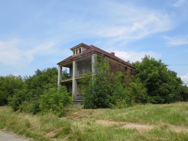
Decaying home near Detroit’s abandoned Packard Automotive Plant

A Drop of Water

Walking along Newark’s Pequannock Aqueduct from source, to tap, to sewer

.

The general public views rural, suburban, urban, and industrial areas as being separate with different land uses, populations, and landscapes. The rural reaches and forests of northwestern New Jersey exist outside the imagination of Newark residents, as if these green mountain lakes with WASPy names have nothing to do with their lived urban experiences in the concrete and asphalt jungle. For the suburban and rural residents of West Milford, Ringwood, Wanaque, Bloomingdale, Kinnelon, Rockaway, Jefferson, Hardyston, and Vernon where Newark’s water supply originates, the experiences and troubles of Newark seem similarly distant, as if the quality of their forest oasis has nothing to do with the health outcomes of Newark residents. However, Newark’s century-old system supplies a half million people with clean water and invisibly knits together the fates of diverse communities along its buried path.

.

Handmade drawing of Newark’s Pequannock water supply system, dated December 1892
The red line traces the path of the aqueduct from start at the Macopin Intake to end at South Orange Avenue. Green is the area of the watershed. The red graph beneath charts the relative height of the aqueduct above sea level at each point in the route. The aqueduct does not flow in a continuous downhill slope. Rather it hugs the ground just below the surface.

.

Map of Newark water supply system in 1946, showing the Pequannock system opened 1892 (lower left) and Wanaque system opened 1930 (upper left). View full size map from Newark Public Library website.

.

Over winter 2021, I documented the route of the Newark aqueduct from its origins in West Milford Township to its terminus in Newark Bay. I trace the path of Newark’s 26-mile-long aqueduct and 63-square-mile Pequannock Watershed and 94-square-mile Wanaque Watershed on the interactive map below.

.

Click on water features to display details of name, dimensions, or volume.

■   Watersheds
■   Reservoirs (7 total)
~~ Aqueducts (~55 miles total)

■   Towns supplied with Newark water (~10)
■   Towns relying on Newark sewers (48)
~~ Main sewer interceptor (~ 28 miles total)
      Along path of Passaic River from Paterson to New York Harbor via Newark

Read More

.