• This website includes dozens of videos, hundreds of essays, and thousands of drawings created over the past twenty years. Search to learn more about the history of buildings, places, prisons, Newark, New York City, and my PhD research on spatial inequality.

  • Or scroll down for the latest publications.

A History of Historic Preservation in New York City

Data analysis of NYC landmarks since 1965 reveals trends and biases in the landmarks preservation movement.

Developed with urban historian Kenneth Jackson at Columbia University’s Department of History

.

.

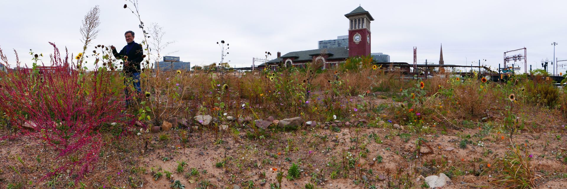
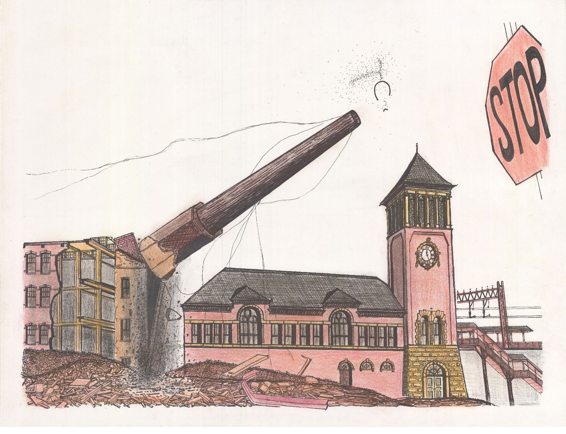
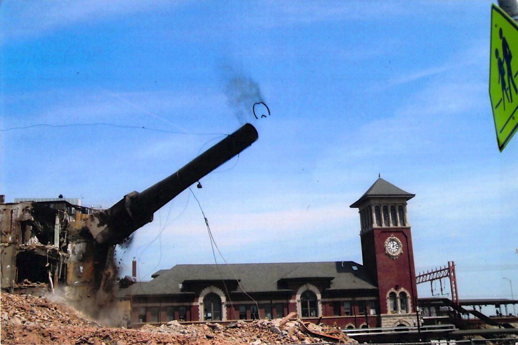
A visual history of landmarks preservation in NYC. Data from NYC Open Data. Music from Freesound.

.

Introduction

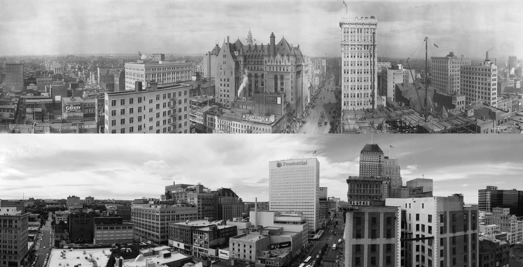
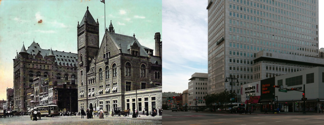
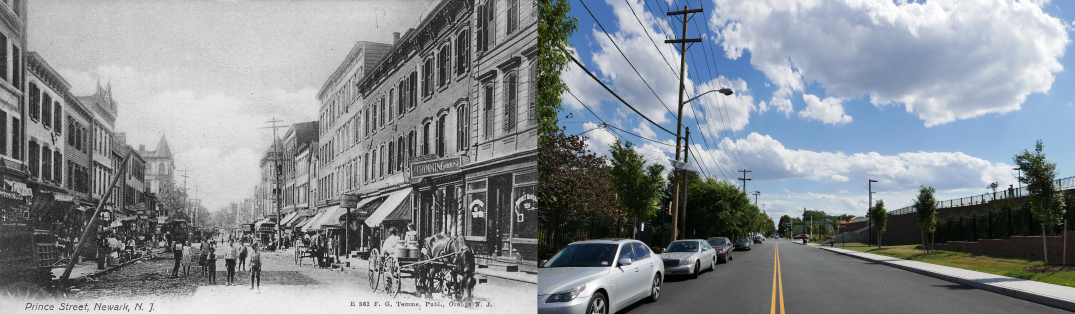
There is ongoing debate between in NYC between developers seeking to rebuild the city in the image of global capitalism and preservationists seeking to slow the rate of change and protect the appearance of the city’s many and distinct neighborhoods. Several factors drive historic preservation: fear of losing heritage; fear of change; historians, public servants, and well-intentioned activists in the spirit of Jane Jacobs. This debate has played out every year since 1965 through the hundreds of structures that are added to (or rejected from) the Landmarks Preservation Commission’s running list of landmarks (LPC). Once added, landmarked buildings cannot be modified without first seeking approval from the city. Landmarks preservation is contentious for developers because the protections of preservation law are permanent and affect all current and future owners. Preservation law further restricts significant rebuilding, even if demolition and rebuilding are lucrative for the property owner.
Historians decide the future of the city’s built environment. The sites they preserve will become the architectural lens through which future generations will appreciate the past. The sites they approve for demolition will be lost to history. Preservation is a response to larger historical questions: Which aspects of the past are worth preserving? How should the city balance the economic need for development with the cultural need for history?
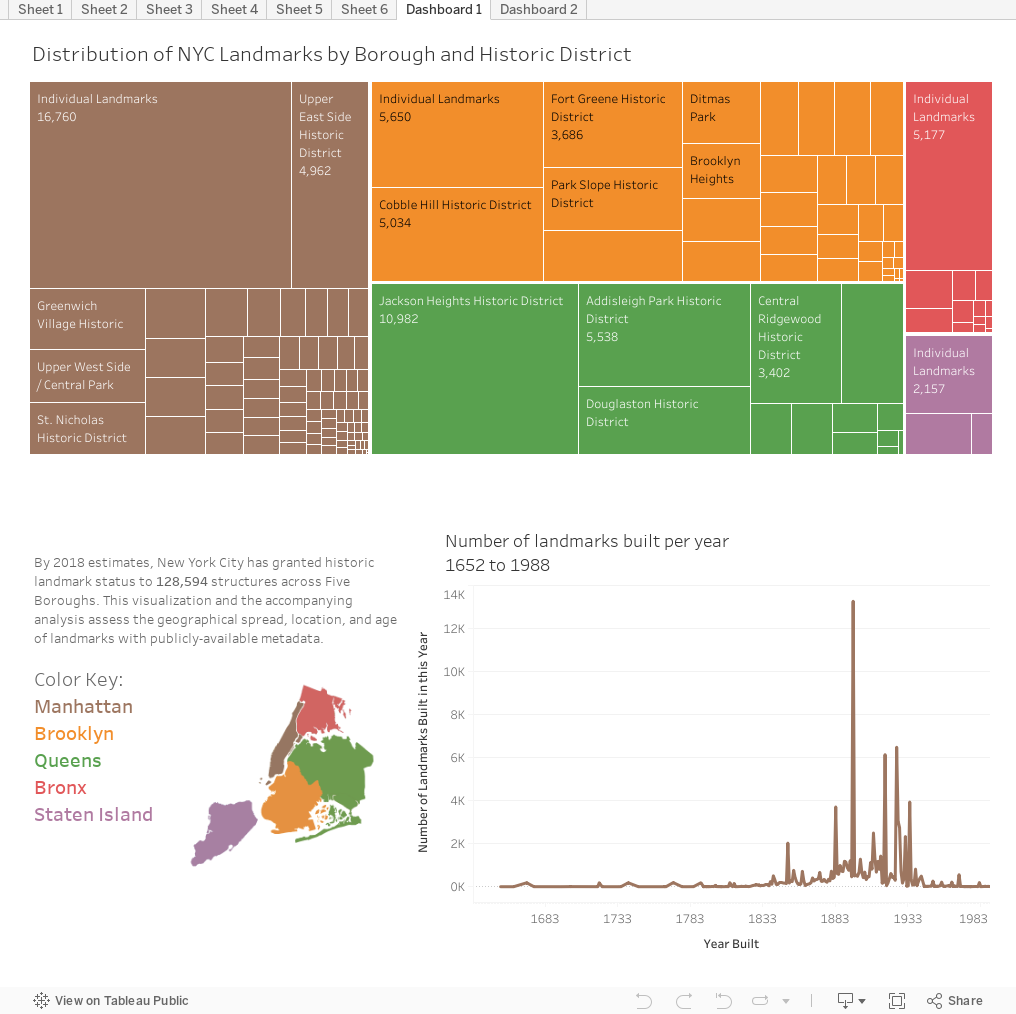
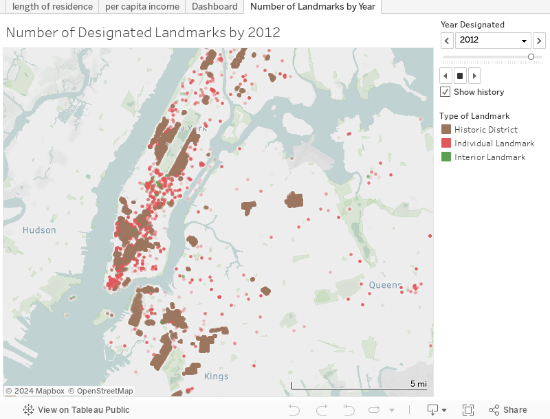
This paper will assess the landscape of historic preservation through analysis of publicly-available landmark records from NYC Open Data. We identified two datasets, both containing ~130,000 spreadsheet entries for every single LPC listing from 1965 to 2019. The first dataset is titled “Individual Landmarks” 1 and includes the structure’s address, lot-size, and date landmarked. The second dataset is titled “LPC Individual Landmark and Historic District Building Database” 2  and includes the construction date, original use, style, and address of all structures. We downloaded both datasets as .csv files, imported them into a visualization software called Tableau, merged them into a single map, and then analyzed the data. The results of inform the conclusions presented here. This analysis is broken into four case studies:
  1. Distribution of Landmarks over the Five Boroughs
    Assesses where landmarks preservation is densest or least dense by neighborhood.
  2. Contextual Preservation?
    Analyzes how protecting a landmark limits redevelopment of neighboring properties of less aesthetic value
  3. How does the preservation movement reflect economic patterns?
    – Factor affecting the preservation of city-owned structures
    – Factors affecting the preservation of residential structures
    – Relationship between preservation and gentrification?
  4. Keeping up to pace?
    Questions the degree to which landmarks preservation succeeds in protecting recently-built landmarks
From this data, hidden trends and biases in historic preservation become visible. Firstly, we identify a higher-density of landmarks in certain (and usually higher income) neighborhoods. Secondly, we identify a marked preference among historians for protecting structures pre-1945. (Is there so little in the city’s recent architectural history that is worth preserving?) And thirdly, our analysis hints at the strength of market forces and developers in shaping the scope and definition of preservation.

Read More

.

.

  1. “Individual Landmarks,” NYC Open Data, https://data.cityofnewyork.us/Housing-Development/Individual-Landmarks/ch5p-r223 (retrieved 5 November 2018).
  2. “LPC Individual Landmark and Historic District Building Database” NYC Open Data, https://data.cityofnewyork.us/Housing-Development/LPC-Individual-Landmark-and-Historic-District-Buil/7mgd-s57w (retrieved 5 November 2018).

A Brief History of Mulberry Bend

At the intersection of history and the immigrant experience

Written for Kenneth Jackson’s Columbia University undergraduate course “History of the City of New York”

.

Mulberry Bend c.1896. Buildings on left side of street are now demolished.[1]

.

Mulberry Bend, nestled between the New York County Criminal Court and the tenements of Chinatown, is at the geographic crossroads of New York City history. At 500 feet long and 50 feet wide, Mulberry Bend is between Bayard Street to the north and Worth Street to the south. Named after the slight turn the street makes midblock, the Bend has a rich, over 350 year history: marsh, city slum, site of urban renewal, and now heart of the Western Hemisphere’s largest Chinese enclave.[2] Through its rich history, the Bend’s brick and wood-frame tenements hosted waves of immigrant groups: Irish, Italians, freed blacks, and now the Chinese, one of New York’s most resilient immigrant groups whose presence in Chinatown reaches as far back as the 1830s. Consistent to these immigrant groups is their struggle to survive and prosper in America. Many of these immigrants, such as the Irish and Italians, have long left the Five Points neighborhood where the Bend is located, leaving few traces of their presence. But the neighborhood was vital as their first point of contact in the New World, a way station between their country of origin and future prosperity in the Promised Land. As such, the Bend exemplifies some of the trademarks of the immigrant experience: a working-class community populated by an immigrant diaspora that emulates the language and tradition of their country of birth. Though their homeland may be distant, in Italy, Spain, Germany, Ireland, or China, they recreated a familiar world beneath the skyscrapers of Lower Manhattan. Neither fully American nor fully foreign, neither a quiet residential street nor busy commercial thoroughfare, the Bend existed and exists as a community of transient identity.
When the Dutch first settled New York, the area of Mulberry Bend and Chinatown was wooded and marshy land. The Bowery, one block east of what would become Mulberry Bend, was a Lenape Indian trail traveling from the tip of Manhattan to the heights of Harlem, about ten miles distant. The New York County Criminal Courts, one block west of the Bend, was the site of colonial New York’s main source of drinking water, the Collect Pond.[3] Change came when the city’s tanning industry developed at the adjoining Collect Pond because it could carry away their industrial waste. The Ratzer Map of Manhattan, dated 1776, even plots the Bend, which bends to avoid the marshy topography of the Collect Pond. Despite this moderate industrial development and gradual filling in of the pond with soil, the area remained marshy and unfit for living.[4]

Read More

.

Excerpt from the 1776 Ratzer Map of Lower Manhattan. The area labeled as “Common” is now City Hall Park, the “Fresh Water” body was known as Collect Pond, and the “Tanners Yards” was the center of the future Five Points Slum. Mulberry Bend is the line in bright red. The dotted land pattern indicated low-lying marshes and woods that have yet to be developed. The grid of streets had been laid out, but had yet to be populated with tenements and businesses.[5]

.

The Geography of Art History

According to the Metropolitan Museum of Art

.

Related: Data analysis and visualization of 120,000 works in the Museum of Modern Art

.

.

In this film, each colored dot indicates one location represented by art in the Met’s online database. Dot location indicates artwork provenance. Dot size indicates the number of objects from this place. The time each dot appears corresponds to the year this work was created. This data is assumed to be an accurate sample size.

.

Over the past few years, the Metropolitan Museum has catalogued over 25% of its holdings online. This represents ~590,000 objects, covering over 5,000 years of human history from 17 curatorial departments. The diversity of objects in a museum’s collection (and the amount of contextual information known about these objects) may reflect the kinds of narratives a museum can curate about artistic and global history. This visualization charts the provenance and year of production of every single object that is catalogued on the Metropolitan Museum website, whenever this information is known.
The geography of art history is uneven. Certain regions, particularly cities, are home to diverse and famous artistic output. Thomas Friedman similarly describes globalization as being spiky and concentrated in big cities. Other regions are comparatively less productive and less studied. Either this reflects museum curators’ historic bias against Africa, Latin America, and the “Global South” in favor of Europe. Or this might reflect a more fundamental historical reality: If geography guides artistic production and privileges regions with good geography, like areas surrounding the Mediterranean, then landlocked and inaccessible regions with poor geography will have less artistic output.

.

.

Art objects from ancient cultures like China, Egypt, and Sumeria frequently have known provenance but unknown year of production. Unfortunately, they are therefore excluded from this visualization. There are many objects in the collections with known provenance but unknown production date. Figure one illustrates objects with known provenance and known year. Figure two shows objects with known provenance only.

.

.

The original data was downloaded here from the Met Museum’s website.
This visualization and interactive map are free to view and download here.

Zoning and Affordable Housing in Newark

Featured June 2017 in this NJ.com news article about my computer simulation

.

.

In the summer of 2017, I helped oppose the gentrification and rezoning of a neighborhood in my city. The area was zoned for buildings no higher than eight stories, which was respectful of the small and community scale of the existing structures. City officials, however, proposed rezoning a large section of the area  to permit structures up to eighteen story structures – four times taller than any other structure in the immediate area.
Motivated by profit, the J&L Parking Corporation lobbied the city to increase the maximum allowed height on their land. Though they had little intention to build anything, this zoning change would increase the value of their property when they decided to sell it in the future. In what is called “spotzoning,” the zoning changes were drawn to exclusively benefit J&L’s properties and the parking lots of the nearby Edison ParkFast corporation.
I created a computer simulation of how the area would appear if the proposal passed and the neighborhood was built up to the maximum density allowed by law . This computer simulation was shown to city officials to inform the planning process.

.

.

City Council Speech

September 19, 2017

.

.

I’d like to speak on why opposing MX-3 is consistent with supporting inclusionary zoning.
To my knowledge, 7 members of the City Council voted in favor of inclusionary zoning. This is an important move to protect our city most vulnerable residents and to preserve affordable housing in our downtown.
MX-3 and upzoning will jeopardize this important piece of legislation.
Why?
inclusionary zoning kicks in when (firstly) developers build structures over 30-40 units and (secondly) they request a variance to build this structure.
When an area is zoned for larger and taller structures developers can build more and larger structures WITHOUT requesting a variance to build larger. And when developers do not need to request a variance for height, it is less likely they will need to include affordable housing in their project.
In effect, MX-3 will remove the requirement to build affordable housing in the effected area. When zoning is overly generous to developers and zoning permits overly large scale, develops do not need variances. And when developers don’t need variances, they do not have to built affordable housing.
In addition, since MX-3 could be expanded to anywhere within a half mile radius of Penn Station, it is quite possible that MX-3 could be expanded in the future. In effect, this would eliminate the requirement for developers to build affordable housing in this area. Upzoning does not benefit affordability.
Secondly, what is sustainability?
Sustainability and transit-oriented development is not just about a short distance to Penn Station. It is not just about green roofs or any type of development.
Sustainability is about affordable housing that we the people can afford to live in. We don’t want luxury condos for the 1% in the MX-3 area. We want development that our residents and you can afford.
All of us can agree that WE ALL WANT DEVELOPMENT. But we want development that is 1. Affordable 2. Respectful of the Ironbound community. And 3. Respectful of our city’s diversity and history.
MX-3 is none of these things. It is about landbanking and benefiting the 1% wealthiest outside our city. I encourage you to strike down MX-3 and to encourage instead an open dialogue with the community about SUSTAINABLE and AFFORDABLE development in our city.
Developers should come to Newark and development should happen. However, we should not upzone entire sections of our city, in effect removing the requirement for affordable housing, undermining the inclusionary zoning we just created, and jeopardizing the recent master plan we created with public participation.

The Digital Cathedral of Amiens

Created with architectural historian Stephen Murray
As featured on Columbia University’s Art Humanities website

.

1. Construction Sequence: 1220-1528

.

Thanks to InUnum Ensemble for recording the accompanying song by Pérotin: Beata Viscera, c.1220


.

1220-c.1225
Master Robert de Luzarches began work on the foundations and lower wall.
He may have been assisted by Thomas de Cormont
1225-30
Master Robert de Luzarches and Thomas de Cormont constructed the south nave aisle
rapidly to provide space for liturgical celebrations
1230-1235
Master Robert de Luzarches and Thomas de Cormont built the north nave aisle
soon afterwards
1240s-c.1250
Master Thomas de Cormont constructed the upper nave and belfries of western towers
c.1250
Master Thomas de Cormont died having completed the upper nave,
begun the upper transept and laid out the lower choir
1250s-1260s
Master Renaud de Cormont completed the upper transept and upper choir
The axial window of the choir clerestory was installed in 1269
1280s-c.1310
Main roof installed from east to west
1360s-c.1400
Construction of west towers
1528
Old steeple destroyed by lightning; construction of the grand clocher doré completed c.1533

.

Text by Stephen Murray

.

.

2. Amiens Cathedral in Cross Section

This film shows the cathedral in cross section,
exploring the relationship between interior and exterior spaces.

.

Music: Mille Regretz by Josquin des Prés

.

Section of choir

Section of western half of cathedral

.

3. Cathedral Flythrough

Viewers approach Amiens from the west, like medieval pilgrims did. Viewers then move through the complex system of flying buttresses that support the cathedral vaults. The animation then reconstructs the dynamic geometry that engineers encoded in the cathedral floor plan. The film closes with the view from below the foundations, as if the cathedral were floating on air.

.

Music: Viderunt Omnes by Pérotin, 1198

.

Section of the nave roof

Section of west façade

.

.

amiens
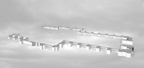
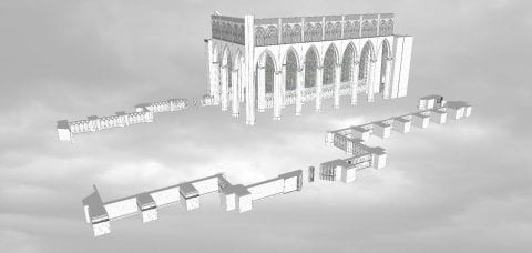
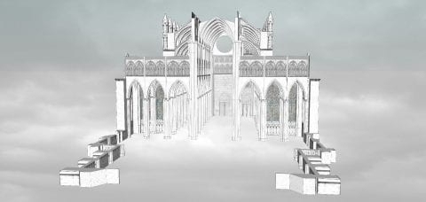
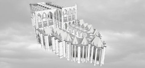
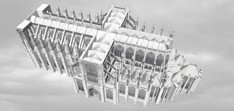
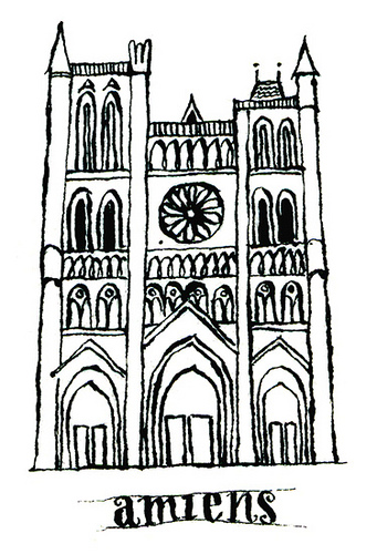
Along with the Parthenon, Amiens Cathedral is introduced each semester to students in Art Humanities. This seminar has been taught since 1947 and is required of all undergraduates as part of the Core Curriculum. Through broad introductory courses in art, literature, history, music, and science, the Core aims to produce well-rounded citizens of Columbia University students. Amiens was chosen as representative of all Gothic architecture, and as a lens through which to teach skills of visual analysis. This computer model I created instructs over 1,300 students per year.
Based on the computer model, I produced the three short films above: (1) a construction sequence, (2) a digital flythrough of the finished cathedral, and (3) a speculative animation of the cathedral in cross section. This trilogy is complemented with music from Pérotin (the thirteenth-century French composer) and Josquin des Prés (the fifteenth-century composer). Both musicians also happen to be featured in the Music Humanities component of the Core Curriculum.
My objective is to digitize and re-imagine Amiens. To borrow a quote from Viollet-le-Duc, the legendary nineteenth-century preservationist-architect of Notre-Dame of Paris, my aim was “to restore the building to a state of completeness that may have never existed.” For instance, Amiens lost almost all of its original stained glass windows and large parts of its nave. My project responds by presenting the cathedral in an idealized light. Awkward walls, later additions, and anachronistic features can all be airbrushed away from my model, so as to reveal how the master masons originally envisioned their cathedral in the thirteenth century.
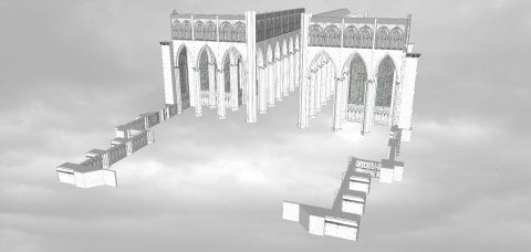
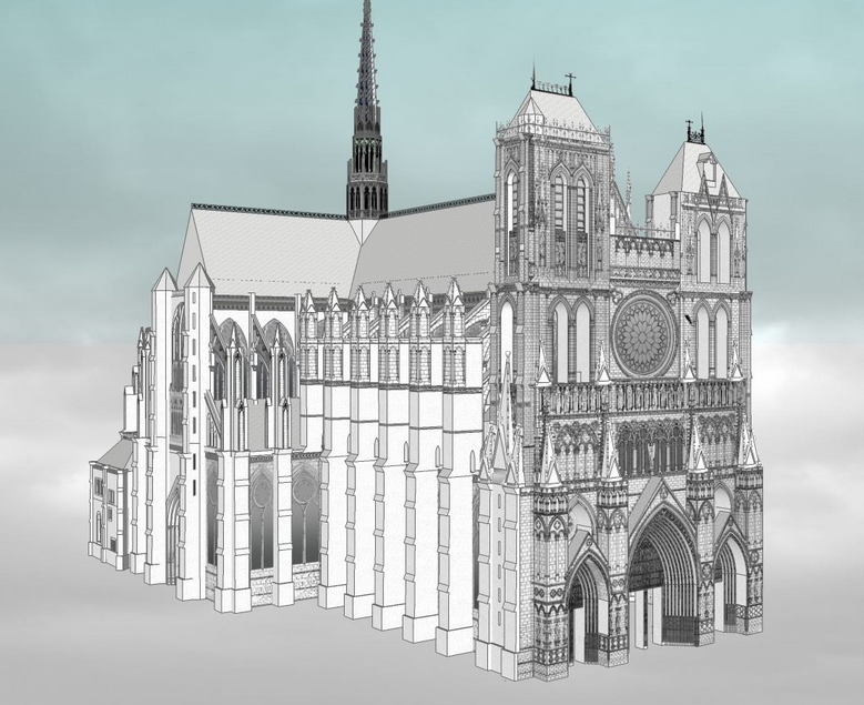
A building is experienced as a sequence of sights and sounds. A research text about such a building, however, can only capture limited information. Photography, film, and computer simulations are, in contrast, dynamic and sometimes stronger mediums to communicate the visual and engineering complexity of architecture. This project seeks to capture dynamic Amiens through a visual, auditory, and user interactive experience. Through film, one can recreate and expand the intended audience of this architecture, recreating digitally the experience of pilgrimage.
In Viollet-le-Duc’s 1863 book, Entretiens sur l’architecture, he presented Gothic architecture as the synthesis of a Roman basilica and a Romanesque church. After several centuries of evolution, these two forms merged into the singular form of the Gothic cathedral. For him, the Gothic cathedral (particularly Amiens) was the pinnacle of human architectural and aesthetic achievement. In other words, the cathedral’s form and plan evolved in response to theology and changes in the rituals of the Mass.
The two animations below illustrate Viollet-le-Duc’s thesis about Gothic. Although later scholars dispute his simplistic analysis, his work remains influential.

.

Evolution of the cathedral from early Christian to late Gothic


Development of the cathedral plan over 1,000 years.
Inspired from Viollet-le-Duc’s writing

.

.

Cathedrals and History

In the absence of surviving written records, many scholars read cathedral construction as a proxy for economic growth, or as a symbol for the structure of medieval society. The decision of where and when to start building a cathedral was tied to the right economic and political conditions. The large majority of cathedrals were built in the region of Northeastern France during the High Middle Ages – during a period of remarkable economic growth and productivity in the thirteenth century. Construction slowed after climate change caused failed crops, followed by the Great Famine (1315) and the Black Death (1350). The economic conditions and cathedral construction never rebounded for a long time afterwards, and when construction did rebound, Europe had entered the Renaissance with a new aesthetic sensibility different from Gothic Amiens
The cathedral can also be read as a political symbol. Funding came from a combination of donations, indulgences, and taxes on church-owned farmlands. The logic between competing regions and feudal kingdoms in medieval France reads something like: the larger and prettier the cathedral, the larger and more powerful the city and sponsors behind it. For many of these towns, the size of the cathedral was well out of proportion to the actual size of the town. Amiens, for instance, was one of the largest cathedrals in Europe for a town of ~26,000. The other cathedral town of Chartres was, similarly, competing with Paris for power and independence. Cathedral were architectural symbols for the competitions between cities and regions. In this light, the cathedral became as much a religious space as a political statement of civic identity.

.

Credits

I am indebted to the expert guidance of medieval historian Stephen Murray, who mentored me in the fall 2016 seminar Life of a Cathedral: Notre-Dame of Amiens. I also thank Columbia’s Center for Career Education for funding this project through its Work Exemption Program.

.

Method

Anyone can download and edit this model for free with SketchUp. Over 3,000 people have downloaded this model, and numerous others have 3D printed it as part of their architecture studios. Among software, SketchUp is easiest to learn. Within minutes, students and teachers unfamiliar with SketchUp can build their own models with ease. In response to several rounds of edits and suggestions from Stephen Murray, I finished this model and exported the animation for final edits and special effects.
In this recorded lecture, I describe the workflow and editing process behind this project.

.

Sources

– Based on Stephen Murray’s measurements and drawings of Amiens from 1990 (link)
– And these hand drawings by George Durand from 1901-03 (link).

.

Related Projects

This project is published to Columbia’s website. I expanded on Amiens Cathedral for my senior thesis about the medieval church of St. Denis, and I continued building computer models as a research assistant at Columbia University’s Media Center for Art History.
I also researched the construction of:
The Eiffel Tower
Burford Church near Oxford, England
St. Paul’s Cathedral dome in London
Jeremy Bentham’s panopticon
Notre-Dame of Paris

.

.

The cathedral from your computer

Animated Glossary of Amiens Cathedral

This model shows a section of Amiens’ nave with the labyrinth below. Photo-realistic textures from actual photos and drawings of Amiens enhance the illusion of reality. Click numbered annotations to view details. Click and drag mouse to fly around the model. Please be patient while the model loads.

.

.

Amiens Cathedral Exterior Computer Model

.

.

Amiens Cathedral Exterior Photos

.

.

Amiens Cathedral Interior

Gallery is organized sequentially to mirror the experience of walking through the cathedral.

.

.

Cross Sections

.

.

Dynamic Angles

Computer models allow us to explore architecture in ways not possible in reality. With Amiens floating in the sky, one looks up to the grid of vaults and the forest of columns. The cathedral is real, but the views of it are imaginary.

.

Newark Metamorphosis

A story of urban change told through picture postcards

.

Developed in collaboration with the Newark Public Library
for a summer 2018 exhibition on the history of Newark’s built environment

.

.

An interactive map and photo project about Newark past and present, 1916 and today
Over the past century, Newark lost much of its architectural heritage and urban fabric. Along with cities like Chicago, Camden, and Detroit, Newark’s built environment evolved in response to population loss, urban renewal, and suburban growth. Explore the changing face of Newark in this interactive map with 150 comparative views of past and present streetscapes.
All historic images in this series are selected from the Newark Public Library’s collection of c.1916 postcards. All new photos were taken in 2016 to commemorate the 350th anniversary of Newark’s 1666 founding. My images capture Newark around 1916, at a moment just before American cities entered the automobile era. Postcards were a medium of communication popular in the early twentieth century. Many postcards feature views of Newark’s important landmarks; others are of mundane street scenes and structures. Through color corrections, careful editing, and marketing, these postcards present a curated and idealized view of Newark as postcard artists, business owners, and city planners desired the city to be remembered.

.

Trouble navigating map? Watch video tutorial below.   |   View all images on a single page.   |   Spot a mistake? Contact Myles.

A city is more than its monuments, skyscrapers, and grand civic architecture. A city is a collection of structures, small and large, wood and stone, humble and grand. Newark has preserved its large monuments but has not maintained the cultural and urban fabric of its tenements, wood frame houses, warehouses, and single-family homes. Individually, these small-scale structures are humble and unimportant. Yet collectively, they constitute the living fabric of the city. Too many have been demolished in the name of progress, creating a cityscape radically different from the city’s height in the early twentieth century. For a short video about Newark’s evolving neighborhoods click here.

.

Postcard

Launch map and read essay about urban change.

(Link opens in new window.)

.

Related Projects

Old Essex County Jail
My exhibit on a long-abandoned Newark landmark
Newark Vanishing
A reflection and art project about demolition in Newark
Growing up in Newark
Essay about my childhood experiences in this city

.

Newark, a century after 1916

.

Downtown Newark

Downtown Newark in 1912 and in 2016. Note how the building at right, under construction in 1912, is now abandoned in 2016.

.

In the turn of the century view of downtown Newark, one sees the architectural styles popular at the time: stone and granite victorian and gothic structures. At left, is Prudential’s old headquarters demolished in 1956. At left, is Newark’s central post office. Unlike today, the postal service was central to the functioning of society and was often the most important structure in a town. This post office happens to be in the Romanesque Style popular in the 1880s. After the post office outgrew this structure and moved elsewhere in 1934, the structure was soon demolished in the 1940s to 1950s to construct an unimpressive dollar store. All buildings in this image are currently demolished.

Prudential Insurance headquarters (left) and the City Post Office (right) c.1916. Both now demolished.

.

Prince Street

Prince Street in 1916 and 2016. The complete and total loss of a neighborhood.

.

Drawing by Winsor McCary, which first appeared in a 1928 article "Newark 58 Years from Today"- when Newark would be 150 years from the year of its 1836 incorporation as a city.

Drawing by Winsor McCary from a 1928 article “Newark 58 Years from Today” shows a futuristic city that never came to be.

.

Launch map and read essay about urban change.

(Link opens in new window.)

Mount Pleasant Cemetery

.

Mount Pleasant was the resting place of Newark’s leading industrialists, politicians, and first families. Opened in 1844 and landmarked in 1988, it fell into neglect as Newark’s wealth flowed away to foreign factories and Newark’s people fled to suburbia. It is now a tranquil spot in a hectic city. Cars may speed by on the nearby interstate and the surrounding neighborhood may shrink or grow, but this city of the dead moves at a slower pace. The cemetery stones crumble and weather with rain, its trees grow larger, and its grass taller. Names carved in stone are just as susceptible to the erasing power of time as anything else. The names of Newark’s proud families are memorialized here, while their memories and histories fade away away as slowly as murky waters flow past in the nearby Passaic River.
Click here to see a film featuring more of my artwork about Newark history.

.

Urban Garden in Newark

By Maia and Myles Zhang

.

In time, we will wind our way and rediscover the role of architecture and man-made forms in creating a new civilized landscape. It is essentially a question of rediscovering symbols and believing in them once again. […] Out of a ruin a new symbol emerges, and a landscape finds form and comes alive.
– John Brinckerhoff Jackson, A Sense of Place, A Sense of Time (1994)
.
In the past 60 years, my home city of Newark, NJ has lost 40% of its population and nearly 50% of its buildings.
The timely and needed development of Newark’s land is prevented through a combination of flawed government policy, economic downturns, risk-averse landowners, and lax enforcement of land use laws. As a result, hundreds of acres of prime urban land remain undeveloped as vacant parking lots. There are over 300 acres of paved surface parking lots in my neighborhood (link to interactive parking map). This sub-optimal and low-density land use has consequences for city government (undeveloped lands are taxed less), housing (Newark has a shortage of quality affordable housing), and the environment (parking lots burden the city’s sewer system with surface runoff). American cities are unique in the world for being so built around, and effected by, the car.
One of Newark’s larger vacant parcels was an electric factory and has sat empty for nearly 40 years — 25 years as a decaying warehouse and 15 more years as wasteland filled with yellow crabgrass and decomposing trash. For five years, rusting demolition equipment and a towering pile of brick, steel, and construction debris moldered in the center of the lot — visible to the millions of commuters who pass this site yearly, watching day by day as the building gradually deteriorated into weeds.
Then our family decided to experiment with ways to bring a semblance of new life to this tired soil: a garden. Our proposal to cover this raw earth in spring flowers was denied by the site’s owner, who was afraid community access would weaken his ownership stake as an absentee landlord. Undeterred, on a quiet weekend with few commuters passing by, we slipped behind the barbed wire fence to sow under the smiling sun. The wondrous flower mixture danced out of the plastic seeder, humming a soothing rhythm. Thanks to more nourishing rain, hope germinated from the infant seeds. Soon, sprouts began popping up hesitantly. At first, the green shoots looked no different from the weeds, but with time they grew taller and flowers bloomed — clover, sunflowers, daisies, and Queen Anne’s Lace. Where once commuters walked pass, now they would stop and take photos of our work, with the city skyline rising in background.
Every June, the sanitation workers come with their oily machines and sweaty equipment to level the land of the flowers we planted. With hatchets, they destroy the flowering fruits of our labor and re-expose the rubble strewn dirt. With chainsaws, they chop down the trees that sprout from the chain-link fence. They leave the mauled flowers and trees strewn on the ground where they fall. Over the following weeks, the flowers and leaves dry in the hot sun and return to the dusty earth tones of the dirt from which they sprang. However, each new year, the flowers return more resilient than before, and with more numerous and larger blossoms. In earlier years, the seeds’ return required our help and gentle watering. These days, they return unaided, attracting the occasional bird. The cycle repeats… “Where flowers bloom, so does hope.”

.

Learn more about this project on GoFundMe.
Read more about Newark’s urban decay.
This project was also featured in the spring 2018 edition of Sine Theta magazine.
.

Westinghouse demolition

.

Westinghouse demolition near Newark Broad Street Station

.

.

The chimney falls

.

Newark Broad Street Station

.

Now an urban garden

.

The Panopticon and Trouble in Utopia

Ironically, the most unequal and dystopian of societies are often founded on utopian principles. Utopias, almost by their very nature, have undertones of conformism and oppression. From Plato’s Republic of strict castes and rampant censorship to Thomas More’s Utopia of puritanical laws and slavery, a utopia for the few is often a dystopia for the many. The question then arises: How do the benefactors of utopia confront its detractors? Utopia has several choices. It can maintain its monopoly on media and education, strangling nascent free thought before it grows into free action. Or it can physically punish and oppress free thought, which requires systems to detect and punish dissent. Detection requires gathering information about the populace. Punishment requires control and physical torture: the police, the army, and the prison. Ironically, to maintain power against its critics, utopia often adopts trappings of dystopia.[1]
Despite the seeming differences between them, many utopias and dystopias often resemble the panopticon, a model of the ideal surveillance state. In fact, panopticon, dystopic police state, and utopian society share common goals: total observation, total power, and unquestioned control.

.

The panopticon models the workings of a society.

The panopticon was initially an architectural concept for the ideal prison. Conceived in 1791 by Jeremy Bentham, an English-born philosopher, social reformer, and utopian thinker,[2] the panopticon embodies the ideals of observation, control, and discipline. In its physical form, the panopticon is a circular prison with cells ringed around a central tower from which prisoners can be watched at all times. This slender central tower contains a covered guardroom from which one guard simultaneously surveys hundreds of prisoners (see image below). The panopticon aims for constant surveillance and prisoner discomfort. In this all-seeing system, dissent is detected and discipline is enforced.

Read More

.

View computer simulation of panopticon.

.

Love and Longing in New York

Selected from undergraduate college application essay to Columbia University. Read more.

.

Walking is my form of enlightenment.
I live in Newark.  My city is generally ten degrees hotter than its neighboring environment.  The airport.  The port.  The downtown.  All are blanketed in asphalt that turns my city into a hot desert.
Tens of thousands of cars, and one of the largest garbage incinerators in the country, spew their fumes into my city.  Returning home, the smell of burning garbage often greets me.  As a child, I had asthma.
At night, I am alone.  Nobody my age lives in my neighborhood. From my front window, I see a parking lot for corporate commuters. From my back window, I see a vast parking lot for university students.  Both are desolate after dusk. As an infant, my first words were “demolition” and “truck.”  As a child, I never had play dates; my suburban “friends” feared my city.  As an adult, I hope to see my city’s vacant lots developed.  I keep on dreaming.
The streets of my city are not made for walking.  They are made for driving.  I walk.  I stop.  I wait.  Speeding traffic and interminable stoplights hinder my progress.
But I love walking in New York City.
When I walk, I am free to choose.  Each street guides me forward.  Each intersection is a choice.  Each destination is irrelevant.  When I walk, I sometimes choose a random order of directions, left, right, left, right, right, left, left, straight.  I see where they lead me.  I know not where.
When I walk, I am free to move.  I love walking on the High Line.  I float above the cars that prevent the city from realizing itself as a community.  I see the crowded streets twenty feet below.  I see the gardens on either side of me.  I let the verdantly landscaped path channel me forward.
When I walk, I am no longer alone.  I walk in the footsteps of the millions who passed before me.  I am one among millions, all of us on our separate voyages.  Lawyers.  Butchers.  Tourists.  Homeless.  We all walk alone.  Yet, we are together in walking alone.
When I walk, I see the world.  In Spanish Harlem, street fairs sell traditional Mexican foods.  In college town Columbia, well-dressed university students amble on their way to class.  In the Upper West Side, the shabby chic push their grocery prams.  In Times Square, tourists lug their large shopping bags from theater to theater, store to store.  Finally, after many neighborhoods, I reach the ceaseless bustle of Wall Street.  Tired after many miles of walking, I descend the subway steps.
When I walk, I achieve tranquility. I am happy.
One of my recent projects is painting New York City, neighborhood by neighborhood.  Each day, I choose a new district to stroll through.  Then, equipped with my miniature watercolor palette and notepad, I walk and paint.  I discover the city block by block.  I aim to capture a fragment of what I see through painting.
Like a pianist who memorizes music by heart, the flâneur (or urban pedestrian) embraces the street symphony with his soul and feet.  People’s voices and buildings serve different, but equally important, clefs in the symphony.  As le Corbusier wrote, “… first to look, and then to observe, and finally to discover.”  My countless urban walks enhance my passion for cities, their architecture, their history, and their planning.
Living in Newark inspires me to dream.  Walking in New York City enlightens me to walk.  I am ready to walk my next journey.

.