• This website includes dozens of videos, hundreds of essays, and thousands of drawings created over the past twenty years. Search to learn more about the history of buildings, places, prisons, Newark, New York City, and my PhD research on spatial inequality.

  • Or scroll down for the latest publications.

Civil Rights Rebellion in the Essex County Jail


Season 13, Episode 6 of the series Abandoned Engineering
Streamed June 2024 in Britain, July 2024 in America


A film crew visits and explores the decaying remains of old Essex County Jail in New Jersey, a facility that became a powder keg of injustice that was set to explode in the 1960s Newark rebellions. Learn more about this historic building in our digital exhibit and the oral history video project to remember the hundreds who suffered in this space.
In every episode since 2016, the channel features three abandoned buildings. Each building is selected for its international significance, for important events that took place there, for its aesthetics, for its cultural importance, or the way this site motivates us to rethink and remember otherwise invisible histories of tragedy and pain. For this year’s season, the old Essex County Jail was one of just 24 sites selected from around the world. Other featured sites in past seasons include: parts of the Berlin Wall and Chernobyl, forts built for the Allied landing at D-Day, as well as dozens of equally important but less visited historic buildings and ruins.
Content and inspiration for this documentary grew from my Columbia University undergraduate senior thesis project about this jail, as well as my Cambridge University’s Master’s thesis about the American architecture of solitary confinement. Based on seeing my senior thesis project and reading master’s thesis online, the film crew contacted me about adapting this research for television. I was happy to provide them an interview, all my primary sources from the Newark Public Library, as well as suggested interviews with community leaders Ras Baraka and Fredrica Bey about the carceral state.
For British audiences, view the full series here on SkyTV.
For U.S. audiences, view the full series here on AppleTV. The series is also being syndicated and translated into 20+ languages for international audiences.


Launch digital exhibit about the carceral state in Newark.

.

Eastern State Penitentiary Construction Sequence

Time-lapse animation of the prison’s entire design – building by building virtual model – from the 1820s to present.

.

“The founders of a new colony, whatever Utopia of human virtue and happiness, allot a portion of the virgin soil as a cemetery, and another portion as the site of a prison.”
Nathaniel Hawthorne, The Scarlet Letter, 1850

.

.

Based on:
– Historic architectural plans (1837 report in French, pp. 124-38)
– Primary sources (1830 description)
– Reports on the historic preservation of this prison (1994 Historic Structures Report, Volume II)
Music by Philip Glass from the 1982 film Koyaanisqatsi, starting at minute 37:30
Link to text of audio narration

.

Computer Model

Shows prison as it appeared in the period 1836 to 1877 before later construction obstructed the original buildings.

.

Time-lapse Animation of Triangle Shirtwaist Factory Fire

This animation reconstructs the exact conditions of the workplace, the locations of each fallen body, and the progress of the 1911 fire minute by minute. It is in an accurate-to-the-inch virtual reality model based on trial records, police reports, original measured plans, and primary sources.

.

Audio testimonies from:
Pauline Newman letter from May 1951, 6036/008, International Ladies’ Garment Workers’ Union Archives. Cornell University, Kheel Center for Labor-Management Documentation and Archives.
Louis Waldman eyewitness in Labor Lawyer, New York: E.P. Dutton, 1944, pp. 32-33.
Anna Gullo in the case of The People of the State of New York v. Isaac Harris and Max Blanck, December 11, 1911, pp. 362.

.

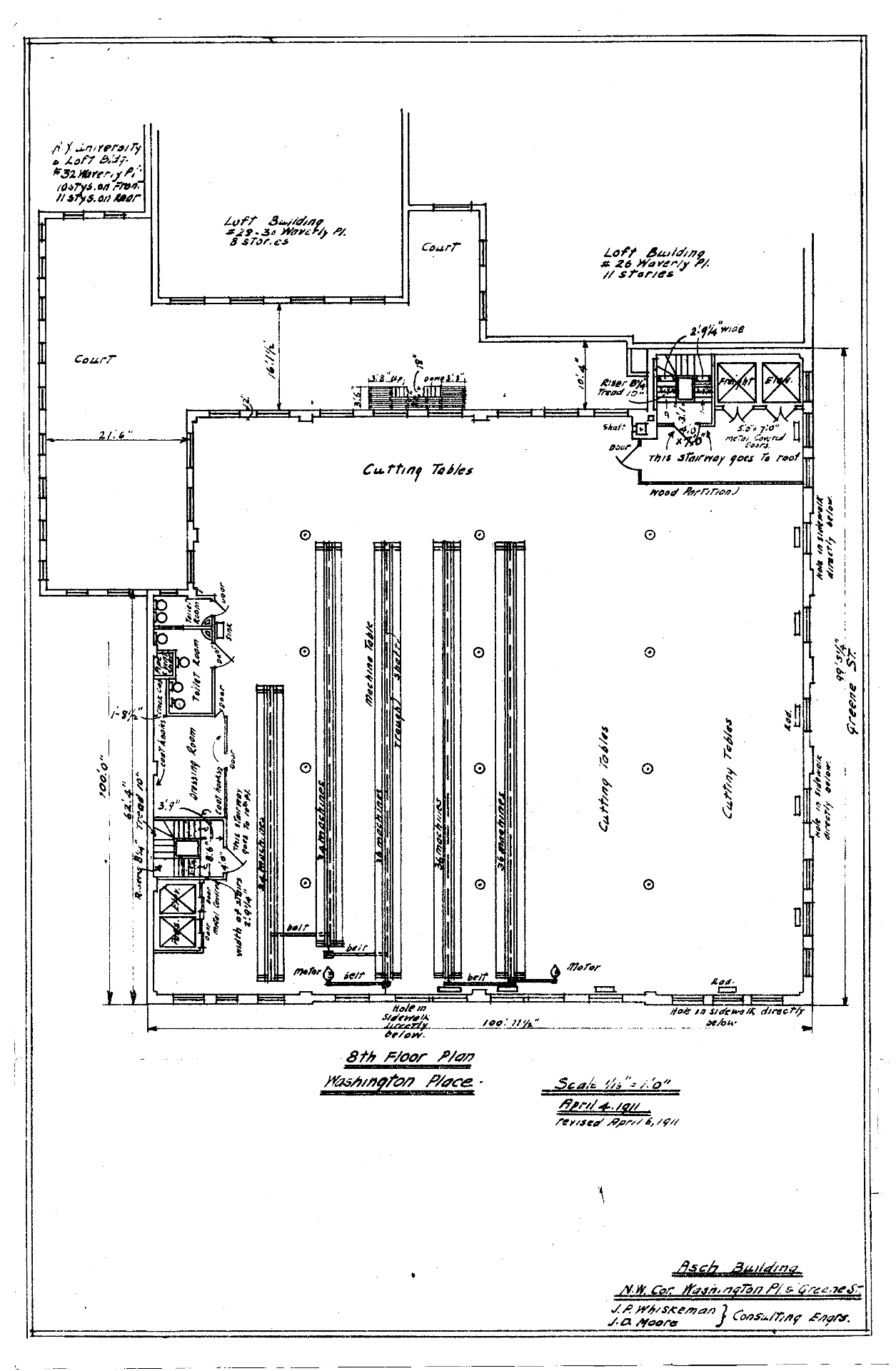
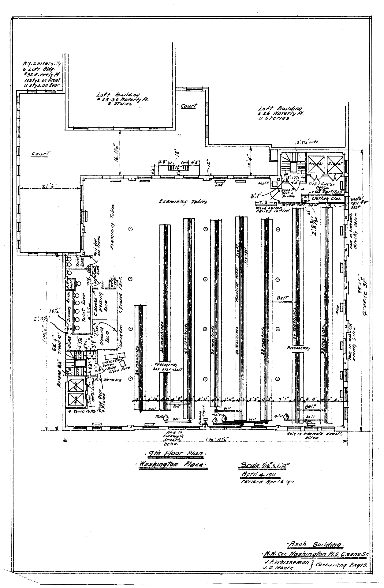
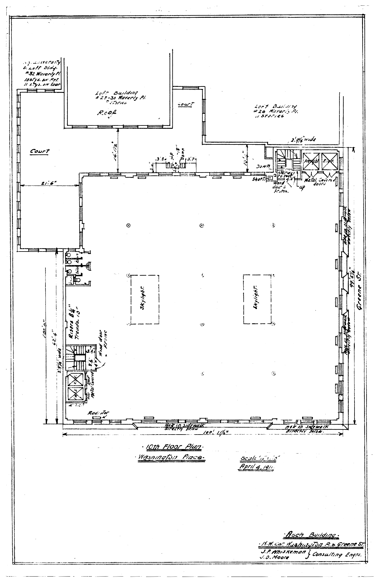
The Triangle Shirtwaist Factory fire on Saturday, March 25, 1911 was the deadliest fire in New York City history and one of the deadliest fires in American history. The factory was located on floors eight, nine, and ten of the Asch Building, built in 1901 for various garment sweatshops in Manhattan’s West Village.
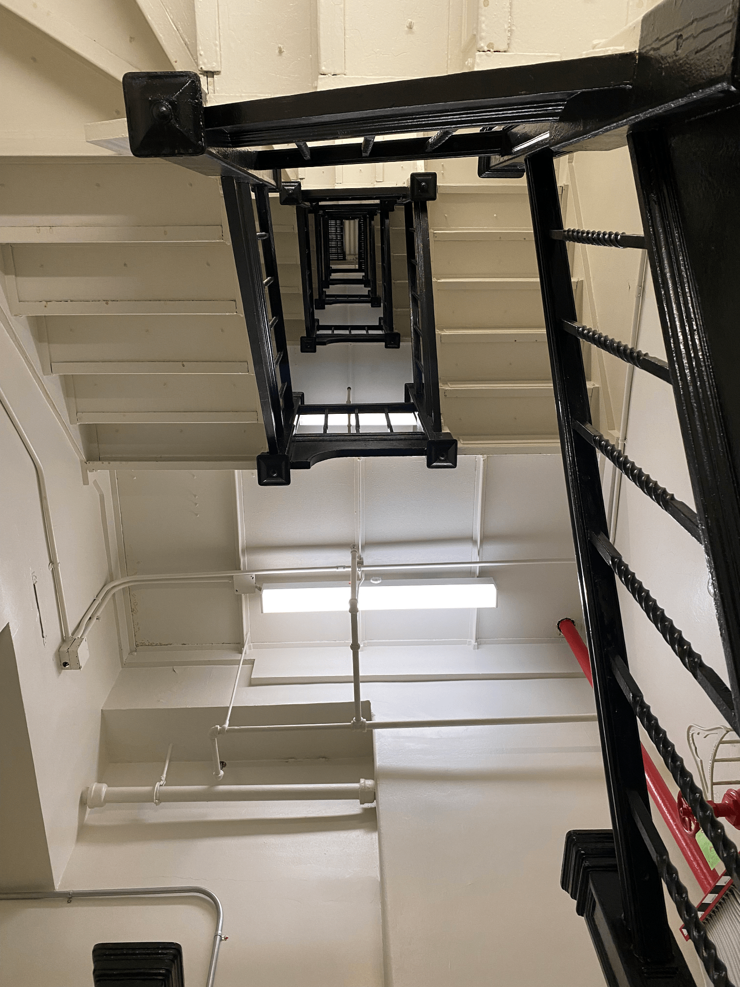
To prevent workers from taking unauthorized breaks, to reduce theft, and to block union organizers from entering the factory, the exit doors to the stairwells were locked – a common and legal practice at the time. As a result, more than half of the ninth floor workers could not escape the burning building.
As a result of the fire and lack of workplace protections, 146 garment workers – 123 women and girls and 23 men – died by fire, smoke inhalation, or jumping and falling from the 9th floor windows. Most victims were recent Italian or Jewish immigrant women and girls aged 14 to 23.
After the fire, factory owners Max Blanck and Isaac Harris were not convicted and were ruled “not guilty.” They “compensated” each victim’s family a mere $75. The fire led to news laws requiring fire sprinklers in factories, safety inspections, and improved working conditions. The fire also motivated the growing International Ladies’ Garment Workers’ Union that organized sweatshop workers to fight for a living wage, job protections, and the right to unionize.
Click on individual annotations in model to fly around the factory and follow the time sequence of the fire.

.

Virtual Reality Model

.

Primary Sources

– Cornell University’s Kheel Center for Labor-Management Documentation & Archives (website)
– The 1,500 page transcript of witness and survivor testimonies (transcript)
– Victim names and causes of death (source and map of victim home addresses)
– Original architectural plans of the building used in the trial (PDF plans and source)

.

Architectural Plans

.

Stairway of death: view looking up the Washington Place stairway that was locked during the fire

Audio Sources

Horse drawn carriage
Power loom
Workplace bell
Classroom
Large crowd
Elevator
Small fire
Large fire
Fire truck bell
Fire hose
Dull thud
Heartbeat
– Closing song: Solidarity Forever by Pete Seeger, 1998
– Closing song: Solidarity Forever by Twin Cities Labor Chorus, 2009


Time-lapse History of the United States

This animation visualizes 272,000 data points spanning 220+ years of the U.S. census since 1790. With data from the National Historical Geographic Information System (NHGIS) at the University of Minnesota, I geo-referenced racial dot maps for all ten year intervals since 1790. Overlaying and fading time-lapse cartographies into each other reveals the scale of environmental and urban change.
● Each dot represents 10,000 people.
Top ten largest cities for each decade are labeled in orange.

Musical accompaniment by Philip Glass from the 1982 experimental film Koyaanisqatsi. In the Hopi language of the indigenous peoples of Arizona, the word koyaanisqatsi means “life out of balance.”
As you watch the map, ask:
1. How is the transformation of Indigenous lands into ranches and farmlands made visible in this film?
2. How do immigration and state policies change the built environment? In what ways are immigration and the law visible from the bird’s eye view of this film?
3. How has slavery influenced the demographic landscape and sequential racial dot maps shown in this film?
4. How do changes in transportation technology – in the sequential eras of the canal, the railroad, the highway, the airport, and now the internet – impact how people settle and distribute themselves across the built environment?

.

Sources:

1. Steven Manson, Jonathan Schroeder, David Van Riper, Tracy Kugler, and Steven Ruggles. IPUMS National Historical Geographic Information System: Version 17.0 [dataset]. Minneapolis, MN: IPUMS. 2022. http://doi.org/10.18128/D050.V17.0

2. Social Explorer. https://www.socialexplorer.com/

3. U.S. population over time

4. Top ten largest U.S. cities over time

Cathedral of Beauvais: Sublime Visions; Thwarted Ambitions; A Sketch

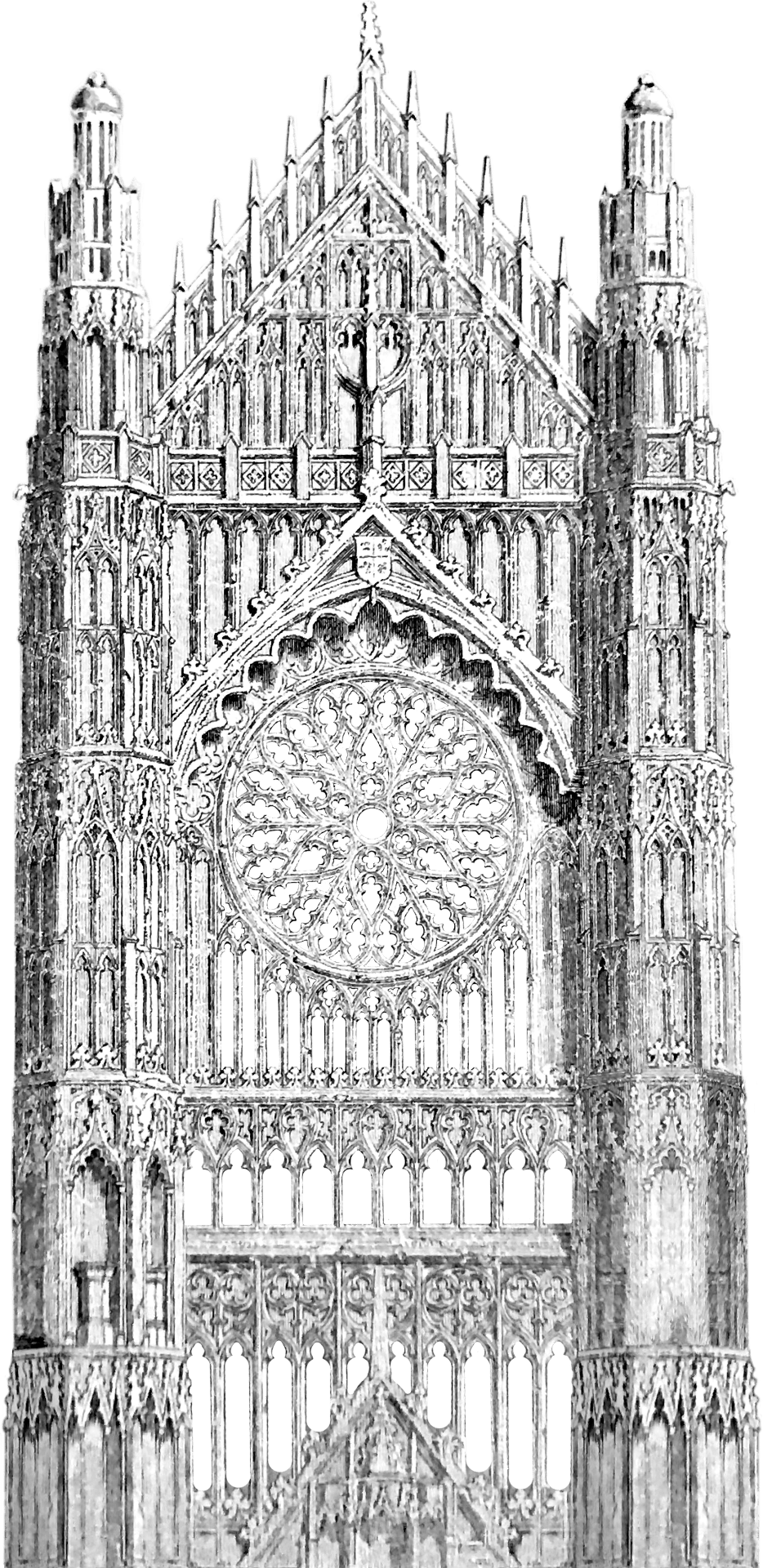
Of all the stories of the greatest Gothic cathedrals, the tale of Beauvais is the most exciting. Construction of the Gothic cathedral began in 1225 at a time of bitter turmoil when France was establishing itself as a nation within its familiar modern geographical bounds. Beauvais, the tallest cathedral in France, was never completed, having endured two major collapses and a series of structural crises that continues to this day. Our Sketchup animation follows this dramatic narrative, allowing the viewer to experience and understand the famous collapse that brought down the upper choir in 1284 as well as the underlying design features that led to that disaster. Particularly intriguing is the visualization of the short-lived crossing tower constructed in the mid-sixteenth century and the rivalry between S-Pierre of Beauvais and Saint Peter’s in Rome.
It is hoped that besides appealing to a general audience of cathedral fans, this movie will be useful in the context of the classroom at high-school and university levels.

Directed by Stephen Murray

Produced by Myles Zhang

Special thanks to Étienne Hamon

Explore more

Further reading: Stephen Murray. Beauvais Cathedral: Architecture of Transcendence. Princeton University Press, 1989.
Visit Mapping Gothic for further photos and a panoramic tour of the cathedral interior.
Visit this link to download image stills of the cathedral at various stages of completion, for reuse in print publications.

Source files

Creating this animation required creating a computer model of the entire cathedral at all stages of construction. This model is shared below; click and drag your cursor to move around this virtual space.

Email [email protected] and [email protected] for access to source files.

High-resolution image stills from construction sequence

1220s fire to 1284 collapse
Before vs. after 1284 collapse
After 1284 collapse vs. after 1300s rebuilding
1284 collapse to 1550s transept
Proposals for completing cathedral
Proposed cathedral vs. actual extent of construction by 1573 collapse
Contemporary

Image sources

Hand-drawn image textures used in this model are based on actual scanned drawings of the cathedral: floorplan, choir section, choir elevation, and hemicyle section.

Audio sources

High medieval music: Viderunt Omnes by Pérotin, 1198
Late medieval music: Ave Maria by Josquin des Prez, c.1475
Contemporary cathedral: Pierre de Soleil by Philip Glass, 1986
Sound of material buckling
Sound of structural collapse

Historical Reconstruction of Ford Model T Assembly Line

As featured on Kottke.org
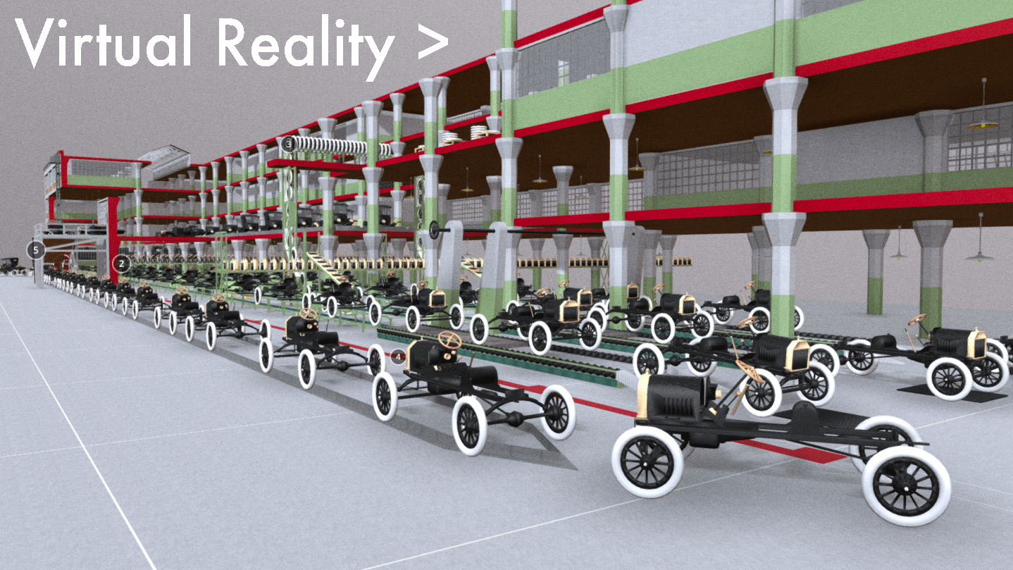
This digital model and film show, for the first time, the entire Model T being assembled from start to finish in a single time-lapse shot of the Ford factory in Highland Park, Michigan. Numerous photos were taken and some films were made in the 1910s and 1920s, but no film from the time tracks the entire car’s assembly from start to finish. There were many types of Model Ts produced, but the specific car shown here is the 1915 Model T Runabout. Watch the film and see as the various car components are hoisted over and bolted into place. Or walk across the factory floor in the virtual reality computer model.

.

The film’s audio replicates the sound of Model T production. The accompanying music at start and end is from the 1936 film Modern Times, where comedian Charlie Chaplin parodies Ford’s assembly line production methods.

.

Explore Model T assembly in virtual reality.
Give thirty seconds for browser to load. Link opens in new window.

.

Henry Ford did not invent the car, nor he did invent the assembly line to produce the car. For years before Ford, cars were being built in small numbers at local workshops. For centuries before Ford, assembly line production was being used to make all manner of goods like pins, fabrics, and steel. At the same time as Ford, others were making cars and building assembly lines.
Ford was not the first, but his car and moving assembly line were certainly the most successful and memorable. After creating his version of the automobile in 1896, Ford moved workshops first to Mack Avenue and later to Piquette Avenue in Detroit. These first two factories were small-scale structures for limited car production. Only in 1913 at Ford’s third factory at Highland Park did mass-production begin on a truly large scale. As shown in this film, here Ford applied assembly line methods throughout the factory to all aspects of car production.

.

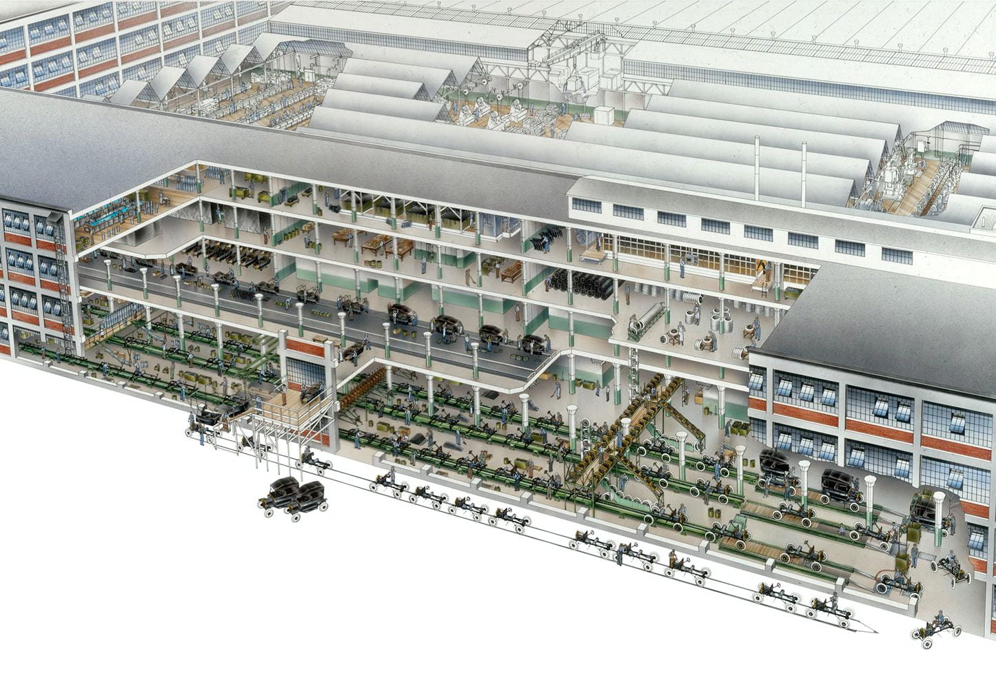
Final Stage of Model T Assembly in Highland Park c.1915, David Kimble’s illustration for National Geographic

.

Between when the first Model T rolled off the assembly line in 1913 and when the fifteen millionth rolled off in 1927, the car’s appearance did not change significantly. The car chassis, motor, and color-scheme in 1927 were almost identical to 1913. Despite variations in the number of seats and exterior of car, the motor and chassis beneath were consistent and unchanging over time. Henry Ford liked it that way to bring down costs and to produce the greatest variety of car types with as few variations as possible to the car’s internal structure.
However, although Ford resisted changes to his car design, he was always redesigning the factory floor and assembly line to produce the greatest number of cars with the least amount of human labor. In this same period from 1913 to 1927, the Highland Park factory was constantly redesigned and expanded. Few records survive of all changes to the factory. However, the 1915 book Ford Methods and the Ford Shops includes detailed plans and photos of the factory at one point in time. Ford was still tinkering with the assembly line, as Model T production had begun just over a year before this book was printed. Within a few months of these photos, assembly line methods had improved once again as Ford redesigned the factory floor shown in this film. Rather than documenting Ford production for all time, this film captures Ford production the way it looked in the months it started.

.

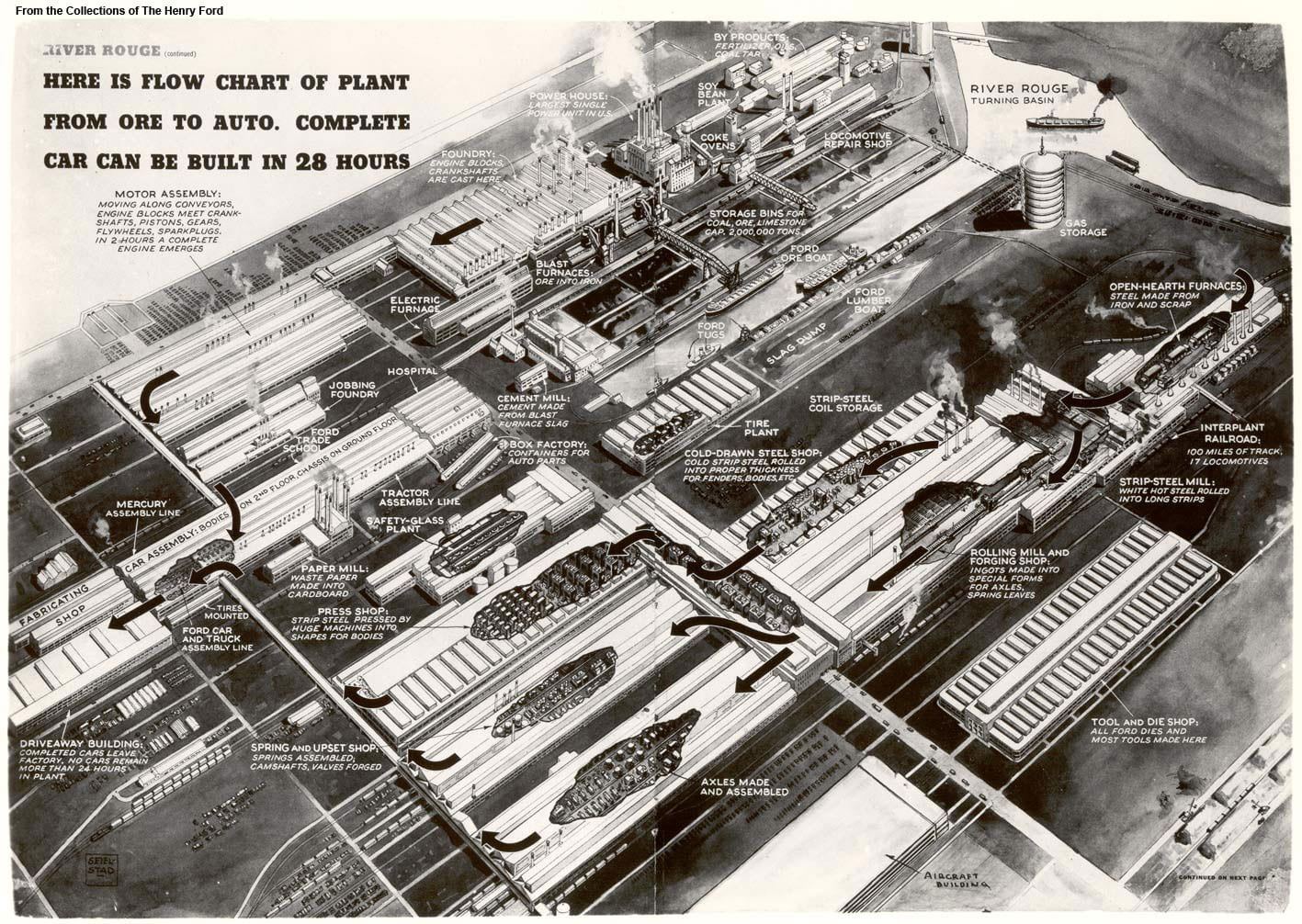
Assembly line flowchart of River Rouge c.1941, showing Ford’s production methods applied to the design of an entire complex. The ideas in embryo at Highland Park become fully visible at River Rouge.

.

After Ford stopped producing Model Ts in 1927, newer models started production at the new and larger factory at River Rouge, where Ford makes cars to this day. The Highland Park factory switched to producing other goods like tractors and later tanks for WWII. Within a few years, production methods had so quickly improved under Ford that Highland Park became too small and obsolete. The factory was largely demolished, and with its demolition the initial appearance of Ford’s first and greatest invention was lost for all time: the moving assembly line.
Some of the factory buildings still stand, and the specific part of the factory shown in this film still exists. But the buildings were all cleared of their original machinery, and the most impressive part of Ford’s invention was not the factory itself but instead the equipment and processes within that factory that are no longer visible. The buildings themselves were simply functional warehouses designed with large open spaces to allow the easy movement of machinery.
The entire complex covered many acres, and the other factories that supplied the Highland Park factory with materials and components created a web of trade that spanned the globe. Instead of filming the entire process, this film focuses on the final and most important stage of production where finished parts from all over the world and factory complex came together for final testing and assembly.

.

Sources

Main reference text: Fay Leone Faurote and Horace Lucian Arnold. Ford Methods and the Ford Shops. New York, Engineering Magazine Company: 1915. See esp. Chapter V on “Chassis-Assembling Lines” that includes factory floor plan and photos from pages 131-57. Also see pages 142-150 that describe the 45 steps required for chassis assembly. Link.
Main reference photo: David Kimble. “Exploring the Model T Factory.” Motor1.com. September 1, 2017. Link. Kimble’s image originally published in June 1987 National Geographic centerfold.
Animation opening image: Postcard of Highland Park in 1917. Link.
Animation opening music: Factory Scene from Modern Times, directed by Charlie Chaplin in 1936. Link.
Model T shown in film can be downloaded as a computer model at this link.

Street Grid Development vs. Population Density

Adapted from Shlomo Angel and Patrick Lamson-Hall’s NYU Stern Urbanization Project,
here and here.

.

The animation at left shows street grid development from 1801 to 2011, mapping Manhattan’s gradual expansion north. The animation at right shows the population density over time of each census tract in Manhattan. Notice how Manhattan’s population density rises and peaks around 1900 before falling to present levels. Despite Manhattan’s appearance of being denser and more built up with skyscrapers than ever before, the island actually has a lower population density than a century ago.

.

.

Before the introduction of subways in the early twentieth century, the difficulties of commuting distances over land and water drove a denser form of urbanism than today. By 1900, the island of Manhattan had over 2.3 million residents in comparison to only 1.6 million in 2020. These people were crowded into dense blocks with upward of half a million people per square mile. The subways had not yet opened, suburban sprawl had not yet arrived, there were no rail connections under the Hudson River, and Manhattan had few or no road connections with the other boroughs and the mainland. This produced an island of remarkable density with the Lower East Side the densest place on earth, while only a few miles north, Harlem remained almost rural.
In 1903, the Williamsburg Bridge over the East River linked the Lower East Side with undeveloped Brooklyn. The trolley lines, subways, and roadway that stretched over the Williamsburg accelerated the development of Brooklyn, first in the higher density parts of Brooklyn closest to Manhattan and later to the distant parts of Brooklyn and Queens with suburban population densities. Suburban growth started earlier than the 1950s image of Levittown, and with the movement of people outwards from Manhattan, the centers of immigrant cultural life shifted, too. In every following year, the Lower East Side lost people, arriving at a density in 2020 only a sixth of what it was in 1900.
Over the following decades, improvements in public transportation and the introduction of the car “smoothed” out the population density. At the same time, Manhattan’s street network expanded to cover the whole of the island from end to end. As the subways made commuting easier, people no longer need to live within walking distance of where they worked. As a result, many industries remained in Manhattan while their workers moved to other boroughs, and later still to the more distant suburbs. As a result, the population densities of Manhattan today are more consistent from one end of the island to the other. Unlike in 1900, Harlem today is about as dense of the Lower East Side because transportation has made one part of the island almost as accessible to work as any other part of the island.
This animation illustrates Manhattan specifically, but Manhattan’s growth and population densities were influenced by larger population and technology changes in the New York region.

The Detroit Evolution Animation

Created in gratitude to the University of Michigan’s PhD program in architecture
Related: The New York City Evolution Animation

.

Soundtrack: “Pruitt Igoe” from Koyaanisqatsi, directed by Godfrey Reggio and composed by Philip Glass.

.

This film traces Detroit’s evolution from its origins as a French trading post in the 1700s, to its explosion as a metropolis, followed by its precipitous decline as a symbol of America’s post-industrial urban landscape. The film weaves in details about the city’s politics, population, and technology – all of which influenced the city’s geography and built environment. At each phase in urban history, the built environment grew and was modified in direct response to political events like racial segregation, population changes like the Great Migration, technology developments like the mass-produced car, and government interventions like urban renewal.
The animation tells the story of Detroit specifically and the story of American cities more broadly. To varying degrees, the path of Detroit’s development mirrors hundreds of other smaller cities and towns scattered across the American Northeast and Midwest. No other American city witnessed as large a population loss, as dramatic 1960s racial unrest, or as radical a transformation from symbol of progress into symbol of decay. To a lesser degree, other places in America followed Detroit in lockstep. Urban renewal projects, highway construction, racial tensions, suburban growth, and infrastructure under-investment happened across America, and in parallel to Detroit.
However, the most dramatic transformation of Detroit is left unwritten in this film. Beneath the surface-level events of political conflict and urban change, the largest event in Detroit is not unique to Detroit. As filmmaker Godfrey Reggio describes, the most important theme in the history of civilization is “the transiting from all nature, or the natural environment as our hosts of life for human habitation, into a technological milieu into mass technology as the environment of life.” European cities developed slowly and gradually over centuries, in the process removing all memory of the natural landscape before civilization. American cities are unique in their youth and speed of growth. They are new enough that an active memory survives through place names and written records of the landscape and indigenous peoples who lived there before colonization. As the oldest colonial settlement west of the Appalachians, and as the city that perfected the mass-produced automobile, Detroit becomes the prime symbol of man’s transformation of his home from a natural world into a technological society removed from nature.

View map bibliography and project methodology

Includes links to download all source files on which the film is based

.

The accompanying music is by composer Philip Glass and was written for Godfrey Reggio’s 1982 experimental documentary Koyaanisqatsi. The shifting layers and repetitive phrases of Glass’ music accompany Reggio’s montages of natural landscapes, factory assembly lines, and chaotic city streets. Koyaanisqatsi means “life out of balance” in the language of an indigenous American tribe called the Hopi. In the original documentary, Glass’ music was paired with scenes of desolate streets in the South Bronx, the abandoned Pruitt-Igoe public housing in St. Louis, and ruined skyscrapers falling in slow motion. In my reinterpretation of Glass’ music, the imagery is now of Detroit in maps. The pace and events in the animation are tied to the structure of the music. As the volume and speed of the music increase and decrease, so too does the growth and decline of Detroit.

View music in original context

Pruit Igoe from Koyaanisqatsi; composed by Philip Glass with images by Godfrey Reggio

.

Population Changes to Detroit Over Time

Hover over infographic for details of each census year.

.

The influx of Black people during the Great Migration and the outflow of cars from Detroit’s factories reshaped the city’s built environment and the American public’s perception of Detroit. Detroit is now thought of as a majority-Black city surrounded by majority-White suburbs. Today, 83% of Detroit’s population is Black, and only 11% is White. But the graph above shows that Detroit was majority-White until the 1980 census. For most of its history, Detroit was 95 to 99% White. Today, the majority of the metro region’s population lives in the suburbs that surround Detroit. But until the 1960 census, the majority of the population lived within the city limits. Today, Detroit is so reliant on the car that it has no commuter rail network, no subways, and limited public transportation options. But until the 1950s demolition of Detroit’s light rail network, a majority of residents lived within walking distance of a light rail station for commuting. Detroit’s demographics, suburban sprawl, and transportation options have all flipped in the past century. From a high-density, transportation rich, and majority-White city in 1920, Detroit has become a low-density, transportation poor, and majority-Black city in 2020.
A lot of people say Detroit has terrible public transit design. But from the perspective of car companies, the real estate lobby, and fearful Whites, the system does exactly what it was intended to do: to segregate and divide our country by covert means long after Jim Crow officially “ended.” Failure by design. The failure of Detroit is, in large part, planned and a consequence of government policy decisions that: prioritize suburban growth over urban development; benefit suburban Whites over urban Blacks; and encourage private cars at the expense of public transit.
As the Detroit Evolution Animation plays, the map key on the lower right hand corner indicates Detroit’s demographics at each decade in history. Try to link changes to demographics with changes to the urban form. Ask yourself the questions: How were technology, transportation, and demographic changes imprinted on the built environment? How does the built environment, in turn, shape urban and suburban life?

.

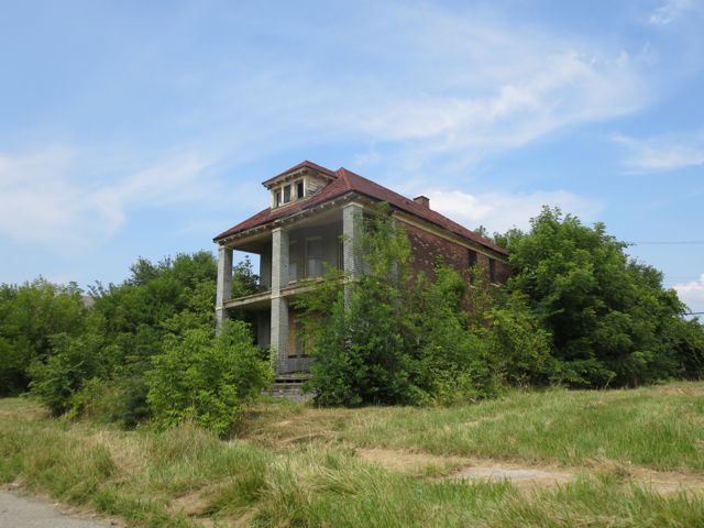
Decaying home near Detroit’s abandoned Packard Automotive Plant

Notre-Dame of Paris Construction Sequence

Created with architectural historian Stephen Murray
As featured in:
1. Notre Dame’s official website
2. Open Culture, May 2021
2. Rebuilding a Legacy, hosted April 2021 by the French Embassy, view recording
3. Restoring a Gothic Masterpiece, hosted May 2021 by the Los Angeles World Affairs Council and Town Hall, view recording

.

1. Construction time-lapse

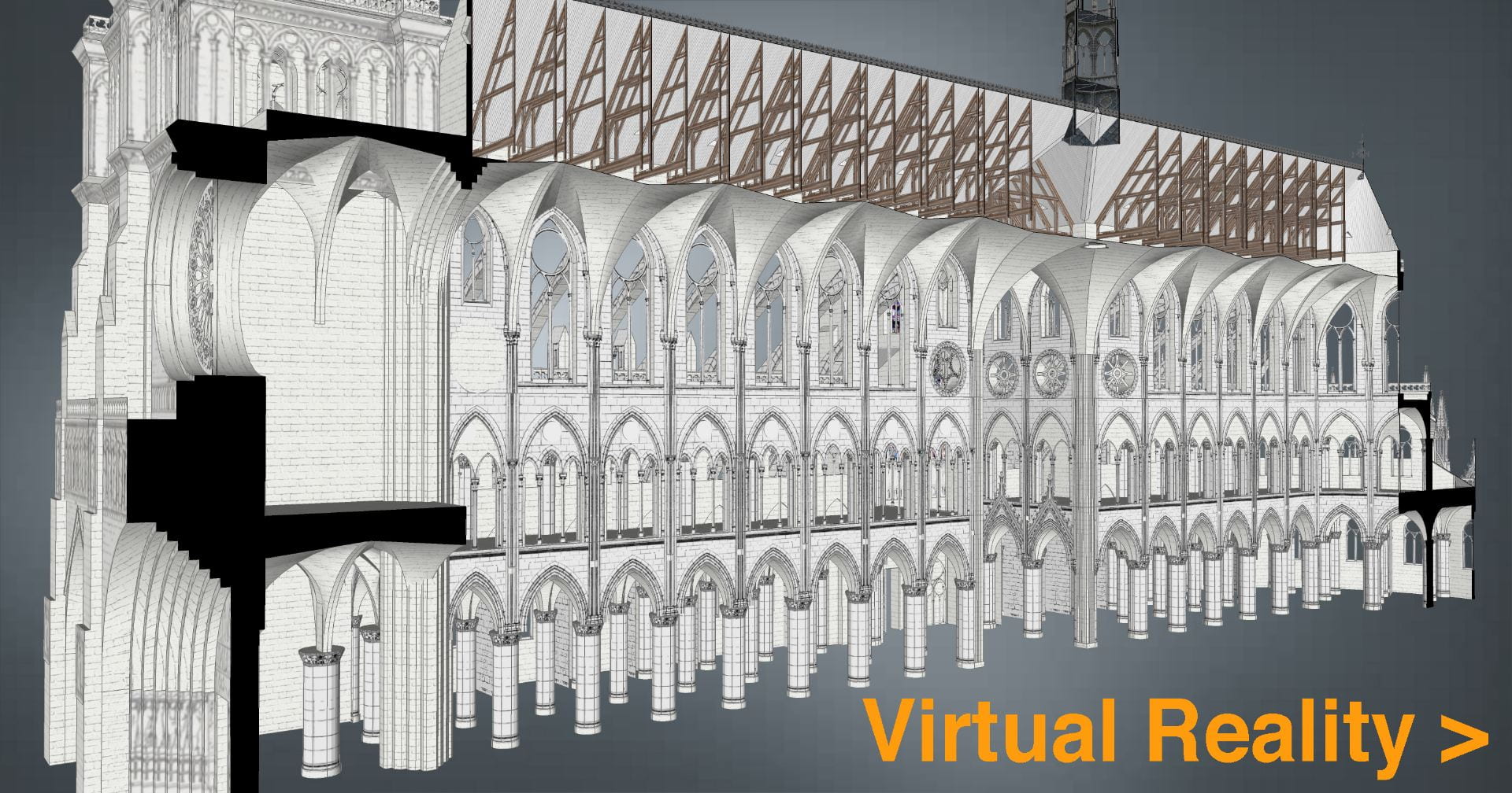
This construction time-lapse illustrates the history of Notre-Dame from c.1060 to the present day, following ten centuries of construction and reconstruction. Model is based on actual measurements of the cathedral and was peer reviewed for accuracy by scholars at Columbia University’s art history department and at the Friends of Notre-Dame of Paris.
The film was created in the computer modeling software SketchUp, based on hand-drawn image textures. The ink drawings of nineteenth-century architect Viollet-le-Duc were scanned and applied to the model surfaces, so as to transform the two-dimensional artwork into the three-dimensional digital. I believe computer models should preserve a certain handmade quality.

.

Music: Pérotin, Viderunt Omnes

View animation with music only.

Read text of Stephen Murray’s audio narration.

.

2. Virtual reality computer model

Explore the interior and exterior of Notre-Dame in virtual reality.
Give thirty seconds for browser to load. Link opens in new window.
Complete model of Notre-Dame inside and out. Download includes simulation of cathedral construction sequence.

.

.

Fire on 15 April 2019

.

3. Research method and work flow

Learn how this model was created – and how to create similar models of your own – with my series of online tutorials shared to this page.

.

4. Computer model and construction sequence sources

– Dany Sandron and Andrew Tallon. Notre-Dame Cathedral: nine centuries of history.
– Eugène Viollet-le-Duc. Drawings of Notre-Dame. From Wikimedia Commons.
J. Clemente. Spire of Notre-Dame. From SketchUp 3D Warehouse.
– Eugène Viollet-le-Duc and Ferdinand de Guilhermy. Notre-Dame de Paris. From BnF Gallica.
– Caroline Bruzelius. “The Construction of Notre-Dame in Paris” in The Art Bulletin. From JSTOR.
– Michael Davis. “Splendor and Peril: The Cathedral of Paris” in The Art Bulletin. From JSTOR.

.

5. Exterior still images from model

.

.

6. Interior still images

.

.

7. Dynamic angles

.

Imagining a world after the coronavirus

Co-created with the Architectural League of New York

.

The converging and ongoing crises of COVID-19, climate change, radical economic inequality, pervasive racism, and racist violence require that all systems, infrastructures, and institutions, including architecture, space, and cities, be reimagined. This reimagining must include how and to what ends architecture, landscape architecture, and urban design can act in the world.
This workshop, organized by The Architectural League of New York, brought architects, planners, and historians in conversation to listen to each other, identify critical issues, and develop ideas about what might and should be done.

.

.

After the virus ends, millions will become used to – and even prefer – work from home. Employers downsize offices. Fewer people commute by car. Our now overbuilt highways and airports will be restored to nature.
Now thousands of vacant offices and buildings will be too expensive and energy inefficient. Abandoned towers, malls, airports, and arenas will become ruins, a modern Acropolis.
Instead of flying to Europe, eco-friendly tourists visit this new “Museum to American Civilization.”
Demolished highways and buildings in flood zones will become landfill. The sedimentary layers in these landfill mountains will be a geological history of American civilization in the Anthropocene.

.

.

Credits

Directed by Tak Ying Chan
Written by  Myles Zhang
Narrated by Natsume Ono
Image credits
Tak Ying Chan (NYC Subway)
Tal Fuerst (Little Italy, Manhattan)
Natsume Ono (Ann Arbor, Michigan)
Hayden Bernhardt (Birmingham, Alabama)
Myles Zhang (NJ Meadowlands)
Special thanks
Julio Salcedo-Fernandez
The Architectural League of New York